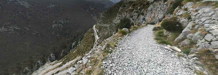
Ruta Urdon-Tresviso is a challenging mule track
Ruta Urdón-Tresviso is the name of a mule track located in the Liebana zone, straddling the Autonomous Communities of Asturias and Cantabria, in Spain. The track is permanently closed to vehicles.

When was the Ruta Urdón-Tresviso track built?
Set high in the Picos de Europa mountain range, the track is totally unpaved and very rocky. It’s called PR-PNPE-30. The track was built during the XIX century to bring materials to the mine of Andara by a society called 'La Providencia'.
Is the Ruta Urdón-Tresviso track challenging?
The track is also known as Subida a Tresviso, La Senda de La Peña, and Ruta a Tresviso. It features countless hairpin turns and very dangerous drop-offs. Extreme care is required. Located in the northern part of the country, the track is brutally steep, hitting a 37% maximum gradient through some of the ramps. The elevation gain is 895 meters, and the average gradient is 15.16%.
How long is the Ruta Urdón-Tresviso track?
The track is 5.9 km (3.66 miles) long, running east-west from the paved N-621 road (Desfiladero de La Hermida) to Tresviso, a picturesque village set high in the mountains. It was used by soldiers during the Spanish Civil War. In winter, there is usually snow, and in summer, it is hot, so be prepared and carry a lot of water.
Is the Ruta Urdón-Tresviso track worth it?
The track features extremely scenic views through Ahileras, Entrelospuentes, las Canalizas de Grezo, canal de Cerrosa, la Vargona, Ciabedo, el balcón de Pilatos (a point with a vertical fall of more than 600m with an incredible view of the river Urdón), Cotero Cruzand, and los Invernales de Prias before reaching the town of Tresviso.
Pic: HIGINIO HEVIA RODRIGUEZ