Here's What You Need to Know about Driving the Strada delle Vette
Located in the Italian region Friuli-Venezia Giulia, the infamous Strada Panoramica delle Vette is one of the most spectacular roads in the world.
Where is Strada delle Vette?
The road is located in the Province of Udine, on the northern part of the country, near the Austrian border.
How long is Panoramica delle Vette?
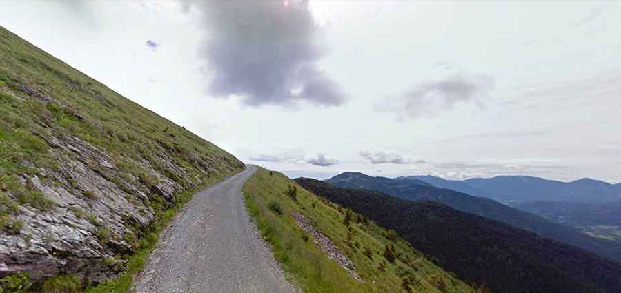
The road is mostly paved except for 6 km of dirt road. It’s 30km (19.13 miles) long, running from Ravascletto (a well-known summer/winter holiday resort in Friuli Venezia Giulia) to Tualis. The road was built between 1940 and 1942. It became famous thanks to the missing leg of the Giro d’Italia 2011.
How long does it take to drive Strada delle Vette?
To drive the beautiful panoramic road without stopping will take most people between 1 and 2 hours. The drive offers stunning views. Speed is limited to 30km/h.
Is Strada delle Vette open?
Set high in the Carnic Alps, in the Dolomites, it’s said to be the highest road open for vehicles in the Friuli region. It tops out at 1.991m (6,532ft) by Monte Crostis. It is usually impassable in winters. Do not take this road during severe weather conditions.
Is Panoramica delle Vette difficult?
If you’re scared of narrow mountain roads, this is not the drive for you. The road is extremely defiant, with 40 hairpin turns, huge drops and extremely narrow parts, so proceed cautiously and hope no other vehicles come from the other direction. It’s essentially a single wide road with no divider line. Better not to do it with large SUVs or campers because the maneuvering spaces are almost non-existent. The inclination is usually somewhere between 12-18% and there is no flat stretch, hitting a 20% of maximum gradient through some of the ramps. Over the whole drive there’s no roof, no place to hide, when a storm hits the exposed place. In some turns use your horn and listen. It can save your life.