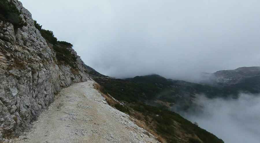
A journey through the legendary Strada degli Scarubbi
Strada degli Scarubbi is a challenging mountain road located on the boundary between the Veneto and Trentino-South Tyrol regions, in Italy. Built during the First World War, the road is closed to private vehicles.

How long is Strada degli Scarubbi?
Set high in the Vicentine Alps, a mountain range of the Eastern Alps, this military road is 10.5km (6.52 miles) long, running from Passo Xomo (1,058m) to Rifugio Generale Achille Papa (General Achille Papa hut) on Porte del Pasubio, at an elevation of 1,928m (6,325ft) above sea level.
When was Strada degli Scarubbi built?
The mule track of Scarubbi was built in 1915, during the First World War by the Italian Army to have access to the summit area of the Pasubio and then to the forefront. Traveled by trucks, however, it was exposed to Austrian artillery near Monte Maio, being on the northern slope of Mount Forni Alti. It was therefore covered under conditions of particular danger, particularly during the night and with lights off. Special techniques were developed to evade Austrian artillery, such as stopping in bends out of sight, making it harder for enemy artillery to target. The road is beautiful but very demanding. What makes it famous are the stunning views, and legend says that you can’t just go there only once. The true surprise that people most often don’t expect when coming to this place is the huge difference in temperature from the bottom to the top, and even from halfway to the top. Because of its northern exposure, it was not usable during the winter and for most of the spring. These factors necessitated the construction of Strada delle 52 Gallerie (Road of 52 galleries), more secure but not accessible to motor vehicles. After the Second World War, the Scarubbi track was the main access route for the first cars of excursionists.
Can I drive Strada degli Scarubbi?
Tucked away in the northern part of the country, the road starts at Xomo Pass (1058m) and goes for about 1.5 km to the average of 10% on a natural background tarred up to Bocchetta Campiglia (1216m). Here the road branches off of the 52 galleries, and there is a big parking lot. From here the road descends for a few hundred meters until Malga Campiglia and then climbs to Caneve of Campiglia, where you climb with 12 switchbacks for 5.7 km to a 9.5% gradient, with very picturesque views from the summit. For about a mile, the road is flat, carved into the rock above the spires of Scarubbi from which it takes its name. This is the more exposed and more dangerous, often subject to small landslides during the spring because of the rains. For the last mile, the road starts to climb winding up at the Gates of Pasubio. However, it continues another mile and a half, even on slopes much more demanding and the bottom is rather spoiled, passing the Arc of the Roman Empire, to the church of Santa Maria del Pasubio at the Harness of Command, the headquarters of the Italian officers during the conflict. Besides the history, also nature and alpine landscapes are good companions. Closed to motorized traffic from the eighties, it is now accessible only to the managers of the refuge Achille Papa, closed with a barrier shortly after Bocchetta Campiglia.
Is Strada degli Scarubbi open?
The road of Scarubbi today is, in fact, the only way used for access to the top of the Pasubio with motorized means. In the intermediate part, the flat, however, prone to landslides after the spring rains and requires annual maintenance consisting of the removal of debris and safety. It is also chosen as the descent route from most parts of the hikers, being much shorter than the Road of Heroes, using the shortcuts on the switchbacks of Caneve of Campiglia. Together with the other rolling stock, it is one of the paths of most historical and scenic interest for mountain biking. Having fallen into disrepair, the Italian government has closed off much of it in an attempt to prevent further injuries and deaths from those driving off the edge because of the cracked surface and loose rocks.
Pic: Filippo Crosara