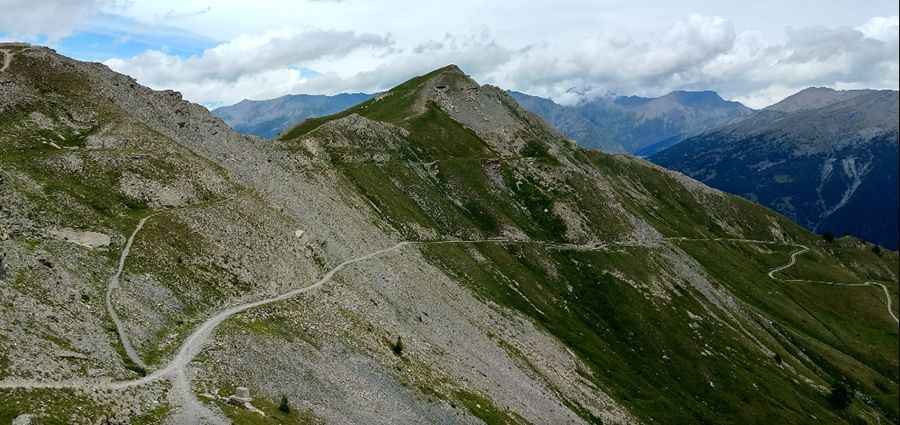
The mule track to the top of Passo della Mulattiera
Passo della Mulattiera is a high mountain pass at an elevation of 2,412m (7,913ft) above sea level, located in the Province of Turin, in the Piedmont region of Italy.
Where is Passo della Mulattiera?
The pass is located in the northern part of the country, near the French border, in Bardonecchia, an Italian comune in the western part of Susa Valley.
Is the road to Passo della Mulattiera unpaved?
The road to the summit is an unpaved mountain road with loose rocks. It’s very narrow and challenging. It is a demanding old military road that becomes a mule track. Built in 1939, the road ends at the pass. The road to the summit starts from Bardonecchia through Mount Colomion, but one could also start from Beaulard and join this road halfway up.
Is Passo della Mulattiera worth it?
At Passo della Mulattiera, there is a huge barrack ruin. This trail passes through remote areas, so you need to be prepared. Located south of Bardonecchia near the French-Italian border, just below the beautiful cliff of Punta Charra (2,844 m), the pass offers you a great panoramic view of Valle Stretta (Vallée Étroite in French) and all the mountains surrounding the valleys of Bardonecchia, Beaulard, and Oulx.
Pic: Marco Savio