What are the most spectacular roads in Italy?
Located in the southern part of Europe, Italy is a dream for drivers as it hosts mountain passes (the Alps), coastal drives (Adriatic, Ionian, Tyrrhenian, and Ligurian), and some of the most famous scenic routes in the world.
It’s nearly impossible to choose only a few roads to drive in the country, as there are about 600 of the most spectacular roads in the world. Stelvio Pass is Europe's most famous road. At an elevation of 2.757m (9,045ft) above sea level, the pass is located in the northern part of the country. It's one of the highest roads of Europe. Featuring 48 hairpin turns, the road through the summit is a marvel of engineering.
If you prefer coastal drives, you must Experience the Breathtaking Amalfi Coast Road. The road follows the shoreline from Sorrento south to Salerno. The road has been featured in films for as long as cameras have rolled at 24 frames per second. If you want to feel like James Bond, don’t skip Strada della Forra. A small car with a functioning horn is recommended. For skilled drivers only. The drive is known by motorcyclists from all over Europe, as it is impressive and not exactly without danger in a few narrow and steep spots. If you prefer roads with a story, don’t miss Strada delle 52 Gallerie, a WWI military mule road. Built on the massif of Pasubio, it was constructed in this position to stay away from Austro-Hungarian artillery fire.
Colle d'Esischie: this road is not for timid drivers
Colle d'Esischie is a high mountain pass at an elevation of 2.370m (7,775ft) above the sea level, located in Piedmont, in northern Italy.
A dangerous unpaved road to Mezzaluna Pass
Passo della Mezzaluna is a mountain pass at an elevation of 1.449m (4,753ft) above the sea level, located in the Province of Imperia in the Italian region Liguria.
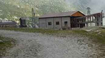
Rifugio Cornisello: this road is not for timid drivers
Rifugio Cornisello is a high mountain refuge at an elevation of 2.160m (7,086ft) above the sea level located in Trentino, in northeast Italy. It’s one of the most challenging drives in the country.
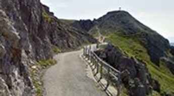
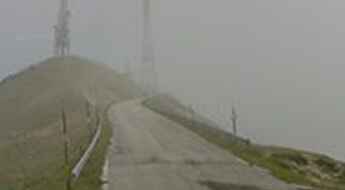
16 hairpin turns to the summit of Monte Nerone
Monte Nerone is a high mountain peak at an elevation of 1.512m (4,960ft) above the sea level, located in the Province of Pesaro e Urbino in the Italian region Marche. Sixteen switchbacks serpentine up and television transmission towers announce the summit.
The wild unpaved road to Colombardo Pass
Passo del Colombardo is a high mountain pass at an elevation of 1.898m (6,227ft) above the sea level, located in the province of Turin in the Italian region Piedmont.
Larche Pass is an awe-inspiring drive in the Alps with 16 hairpin turns
Col de Larche-Colle della Maddalena is an international high mountain pass at an elevation of 2.005m (6,578ft) above sea level, located on the border of Italy and France.
An epic enthralling road to Colle Basset
Colle Basset is a high mountain pass at an elevation of 2.424m (7,952ft) above the sea level, located in the Province of Turin, Italy.
The Ultimate Guide to Traveling the Road SP345B
Strada Provinziale 345B (SP345B) is the name of a high mountain road located in the province of Brescia, in the northern Italian region of Lombardy. It runs almost entirely over 1.900 meters above the sea level.
Colle San Carlo, an absolute must for road lovers
Colle San Carlo is a high mountain pass at an elevation of 1.954m (6,410ft) above the sea level, located in the Aosta Valley region of north-western Italy.
A military road to Colle dell'Assietta
Colle dell'Assietta is a high mountain pass at an elevation of 2.472m (8,110ft) above the sea level, located in the Province of Turin, Italy.
A wild road to Forte del Gran Serin
Forte del Gran Serin is a military fortress at an elevation of 2.602m (8,536ft) above the sea level, located in the Province of Turin in the Italian region Piedmont. It's one of the highest mountain roads of the country.
The Wild Road to Colle del Preit
Colle del Preit is a high mountain pass at an elevation of 2.065m (6,774ft) above the sea level, located in Cuneo, a province in the southwest of the Piedmont region of Italy.
A curvy road with 75 hairpin turns to Colle della Lombarda
Col de la Lombarde-Colle della Lombarda is an international high mountain pass at an elevation of 2.354m (7,723ft) above sea level, located on the border of Italy and France.
The road to Nota Pass is not for the beginners
Passo Nota is a high mountain pass at an elevation of 1.208m (3,963ft) above the sea level, located in the province of Brescia, in Lombardy. The road to the summit starts at the infamous Passo del Tremalzo.
Autostrada dei Fiori, a stunning coastal road from Genoa to Nice
Part of European route E80, Autostrada A10 is one of the most challenging yet scenic highways in northern Italy. You’ll feel constantly distracted by the beautiful views.
A curvy road to the summit of Campolongo Pass
Passo Campolongo is a high mountain pass at an elevation of 1.875m (6,152ft) above the sea level located in the Dolomites in Trentino in Italy.
SS1 Via Aurelia, one of the main roads of the Roman Empire
Strada Statale 1 Via Aurelia (SS 1) is a historic trade route running along the Italian coastline from central Italy to southern France.
A popular curvy road to the summit of Mendola Pass
Passo della Mendola is a mountain pass at an elevation of 1.362m (4,469ft) above the sea level, located between the provinces of Trentino and South Tyrol, in Italy. It is a route which is very popular with cyclists and bikers.
Driving Strada del Vallone di Elva is well worth the time
Strada del Vallone di Elva is a high mountain road located in the Province of Cuneo in the Italian region Piedmont. The road is very steep, with an average gradient of 8.34%.
Adventure along the narrow road to Colle di Valcavera
Colle di Valcavera is a high mountain pass at an elevation of 2.416m (7,926ft) above the sea level, located in the Province of Cuneo in the Italian region Piedmont.
Col du Clapier is where Hannibal crossed the Alps
Col du Clapier-Colle Clapier is an international high mountain pass at an elevation of 2.480m (8,170ft) above the sea level, straddling the Italian-French border.
Regia Trazzera Prestanfuso, one of the steepest roads in Italy
Located in the Metropolitan City of Palermo, Sicily, in Italy, the Regia Trazzera Prestanfuso is said to be one of the steepest roads of the country.
Eira Pass, a beautiful paved road in the Alps
Passo d'Eira is a high mountain pass at an elevation of 2.209m (7,247ft) above the sea level, located in the Province of Sondrio, Lombardy region, in northern Italy.
Plöcken Pass-Passo di Monte Croce Carnico is an absolute must for road lovers
Plöckenpass-Passo di Monte Croce Carnico is an international mountain pass at an elevation of 1.370m (4,494ft) above the sea level, located on the border of Austria and Italy.
The historic paved road to Brocon Pass
Passo Brocon is a high mountain pass at an elevation of 1.616m (5,302ft) above the sea level, located in the western part of Trentino in Italy.
If you love to drive, you will love the Mauria Pass road
Passo della Mauria is a mountain pass at an elevation of 1.298m (4,259ft) above the sea level, located between the regions of Veneto and Friuli in Italy. It connects Lorenzago di Cadore in Veneto and Forni di sopra in Friuli. The pass is traversed by the Strada Statale 52.
An awe-inspiring road to Costalunga Pass
Passo di Costalunga (Karerpass) is a high mountain pass at an elevation of 1.745m (5,725ft) above the sea level, located in the province of South Tyrol in Italy.
Resia Pass is one of the lowest crossings of the Alps
Reschenpass-Passo di Resia is a high mountain pass at an elevation of 1.522m (4,993ft) above the sea level, located in the Trentino-Alto Adige/Südtirol region of Italy, not far from the Austrian border.
A very narrow road to Colle del Vallonetto
Colle del Vallonetto is a high mountain pass at an elevation of 2.439m (8,001ft) above the sea level, located in the Province of Cuneo in the Italian region Piedmont.
A steep (24%) paved road to Nigra Pass
Passo Nigra is a high mountain pass at an elevation of 1.688m (5,538ft) above the sea level, located in the Dolomites in the province of South Tyrol in Italy.
Muro di Campeggio: a devastatingly steep paved road
Muro di Campeggio is a short but devastatingly steep climb in the Province of Bologna in the Italian region of Emilia-Romagna. This asphalted climb is famous as one of the most severe of any road cycling race.
The road to Radici Pass: be ready to make room for oncoming vehicles
Passo delle Radici is a high mountain pass at an elevation of 1.529m (5,016ft) above the sea level, located on the boundary of Emilia-Romagna and Tuscany regions, in central Italy.
The Ultimate Guide to Traveling the Passo di Tanarello
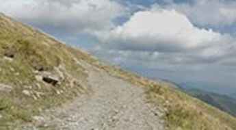
Tanarello Pass is a high mountain pass at an elevation of 2.042m (6,699ft) above the sea level, located on the French-Italian border between Liguria, Piemonte and Provence-Alpes-Côte d'Azur. It belongs to the Ligurian Alps. The road to reach the pass is a gravel dirt track.
A 5 stars road to Monte Croce di Comelico Pass
Passo Monte Croce di Comelico is a high mountain pass at an elevation of 1.636m (5,367ft) above the sea level, located on the boundary of South Tyrol and Belluno provinces, in Italy.
Valles Pass, an iconic road in the Dolomites
Passo Valles is a high mountain pass at an elevation of 2.032m (6,667ft) above the sea level, located on the boundary between the Veneto Region and Trentino Alto Adige Region, in northeastern Italy.
Pramollo Pass is a classic road trip in the Carnic Alps
Passo di Pramollo (Nassfeld Pass) is an international high mountain pass at an elevation of 1.534m (5,032ft) above the sea level, located on the Italian-Austrian border.
