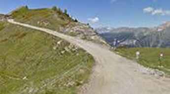
What are the most spectacular roads in Italy?
Located in the southern part of Europe, Italy is a dream for drivers as it hosts mountain passes (the Alps), coastal drives (Adriatic, Ionian, Tyrrhenian, and Ligurian), and some of the most famous scenic routes in the world.
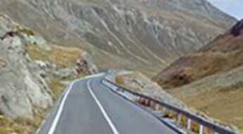
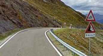
It’s nearly impossible to choose only a few roads to drive in the country, as there are about 600 of the most spectacular roads in the world. Stelvio Pass is Europe's most famous road. At an elevation of 2.757m (9,045ft) above sea level, the pass is located in the northern part of the country. It's one of the highest roads of Europe. Featuring 48 hairpin turns, the road through the summit is a marvel of engineering.
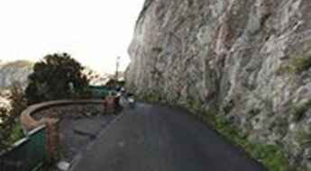
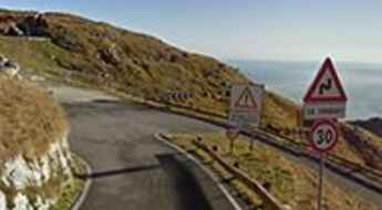
If you prefer coastal drives, you must Experience the Breathtaking Amalfi Coast Road. The road follows the shoreline from Sorrento south to Salerno. The road has been featured in films for as long as cameras have rolled at 24 frames per second. If you want to feel like James Bond, don’t skip Strada della Forra. A small car with a functioning horn is recommended. For skilled drivers only. The drive is known by motorcyclists from all over Europe, as it is impressive and not exactly without danger in a few narrow and steep spots. If you prefer roads with a story, don’t miss Strada delle 52 Gallerie, a WWI military mule road. Built on the massif of Pasubio, it was constructed in this position to stay away from Austro-Hungarian artillery fire.
Via Provinciale Anacapri is a narrow coastal road on Capri
Via Provinciale Anacapri is a challenging coastal road situated on the island of Capri in the southern part of Italy.
A 5-star road to Forcola di Livigno Pass in the Alps
Livigno Pass-Forcola di Livigno Pass is an international high mountain pass at an elevation of 2,315m (7,595ft) above sea level, located on the border between Switzerland and Italy.
Cima Grappa is a classic road of Giro d'Italia
Cima Grappa is a high mountain pass at an elevation of 1,775m (5,769ft) above sea level, straddling the provinces of Treviso, Vicenza, and Belluno in the Veneto region of Italy. At the top sits the Sacrario Militare del Monte Grappa, a monumental burial site for soldiers killed on both sides of World War I.
Pennes Pass is a classic Italian road trip
Passo di Pennes is a high mountain pass at an elevation of 2,211m (7,254ft) above sea level, located in the Trentino-Alto Adige/Südtirol region of Italy.
Road trip guide: Conquering the Italian Via dei Saraceni
Via dei Saraceni is a road that has tested the nerves of numerous drivers, offering one of the most spectacular drives in Italy. Situated in the southwestern part of the Alps, this dirt track extends for over 20 km, reaching heights of over 2,000 meters above sea level, making it one of the highest roads in Europe, accessible exclusively for 4x4 vehicles.
Road trip guide: Conquering the paved San Marco Pass
Passo San Marco is a high mountain pass at an elevation of 1,985m (6,512ft) located on the boundary between Bergamo and Sondrio provinces in the Italian region of Lombardy.
How to travel Strada della Cucca to Pianella Pass?
Passo Pianella is a mountain pass at an elevation of 1,365m (4,478ft) above sea level located in the Veneto region of Italy.
The mule track to the top of Passo della Mulattiera
Passo della Mulattiera is a high mountain pass at an elevation of 2,412m (7,913ft) above sea level, located in the Province of Turin, in the Piedmont region of Italy.
A memorable road trip to Verva Pass in the Alps
Passo di Verva is a high mountain pass at an elevation of 2.301m (7,549ft) above sea level located in the Province of Sondrio, in the Lombardy region of Italy.
Falzarego Pass is a road with 38 sharp hairpin bends
Passo di Falzarego is a high mountain pass at an elevation of 2,105m (6,906ft) above the sea level, located in the province of Belluno, in the Veneto region of Italy.
Colle del Lago dei Signori: everything you need to know about this famed road
Colle del Lago dei Signori-Col de Seigneurs is an international high mountain pass at an elevation of 2,130m (6,988ft) above sea level, located on the border of Italy and France. The road traversing the pass was originally built for military purposes and was used during World War II.
The breathtaking road through Serrai di Sottoguda in the Dolomites
Located in the middle of the Dolomites, in the Italian Belluno province, part of the Veneto region, the road along the Serrai di Sottoguda gorge is one of the narrowest roads in the world. The Sottoguda gorge is closed to traffic; only pedestrians and cyclists are allowed.
Driving the unpaved military road to Colle del Mulo
Colle del Mulo is a high mountain peak, at an elevation of 2,523m (8,277ft) above sea level, located in the province of Cuneo, in the southwest of the Italian region of Piedmont.
A 5-star road to Manghen Pass in the Dolomites
Passo di Manghen is a high mountain pass at an elevation of 2,047m (6,716ft) above sea level, located in Trentino in the Italian region Trentino-Alto Adige/Südtirol. This is a tough climb from both the north and south.
Berga Pass: enjoy a road among the clouds in Italy
Passo della Berga is a high mountain pass at an elevation of 1.527m (5,009ft) above the sea level, located in the province of Brescia, in the Lombardy region of Italy. The pass is traversed by the spectacular Anfo ridge road.
Dosso Alto Pass: enjoy a road among the clouds
Passo del Dosso Alto is a high mountain pass at an elevation of 1.727m (5,666ft) above the sea level, located in the province of Brescia, in the Lombardy region of Italy. The pass is traversed by the spectacular Anfo ridge road.
The road to Lago di Teleccio: be ready to make room for oncoming vehicles
Lago di Teleccio is a high mountain artificial lake at an elevation of 1.918m (6,292ft) above the sea level, located in the Italian region Piedmont, within the Gran Paradiso National Park. It’s a mind numbing vertical drop of hundreds of meters so you might want to give it a miss on a windy day. The road is really steep, with sections up to 15.7% and 20 hairpin turns. It is narrow, so keep the speed down and be ready to move over and make room for oncoming vehicles.
Colla di Sanson is an old unpaved military road in the Ligurian Alps
Sanson Pass (also known as Colla di Sanson, Bassa di Sanson o Baisse de Sanson) is an international high mountain pass at an elevation of 1.694m (5,557ft) above the sea level, located in the Ligurian Alps, a mountain range on the border between France and Italy.
A narrow winding road to Sella Ciampigotto
Sella Ciampigotto is a high mountain pass at an elevation of 1.830m (6,003ft) above the sea level located in the province of Belluno, in the Italian region of Veneto
Monte Chaberton: Get behind the wheels for one of the planet’s most challenging trips
Strada militare dello Chaberton is an extreme high mountain track climbing up to the fort on top of French Mont Chaberton at an elevation of 3.131m (10,272ft) above the sea level. It's one of the highest mountain roads of Europe.
Ultimate 4wd destination: Laghi di Cedèc
Laghi di Cedèc is a high mountain lake at an elevation of 2.833m (9,294ft) above the sea level, located in the northern Italian province of Sondrio. It's one of the highest roads in Europe.
Colle della Boaria is a challenging drive in the Cottian Alps
Col de la Boaire (Colle della Boaria) is an international high mountain pass at an elevation of 2.102m (6,896ft) above the sea level, located in the Cottian Alps, between France and Italy, which links the Queyras valley (Hautes-Alpes) with Pontechianale in the province of Cuneo, Piedmont.
Muro di Guardiagrele is one of the Italian steepest roads
Muro di Guardiagrele is a vertical wall located in Guardiagrele, a town in the province of Chieti, part of the Abruzzo region of central Italy. This asphalted street is a climb that kicks up to 30 per cent gradient and is said to be the steepest street in the country.
A paved road to Sapienza Refuge in Mount Etna
Rifugio Sapienza is a high mountain refuge at an elevation of 1.935m (6,348ft) above the sea level, located in the Province of Catania in the Italian region Sicily, on the southern slope of Mount Etna.
Travelling through the scenic Strada Statale 125 Orientale Sarda
Located on the the eastern coast of the Italian region Sardinia, Strada Statale 125 Orientale Sarda is one of the most beautiful roads of Europe.
The road to Colle l’Azzara is not recommended if you don't know how to reverse
Colle l’Azzara is a high mountain pass at an elevation of 1.595m (5,232ft) above the sea level, located in the Province of Torino, Piedmont, in northern Italy.
Ravenola Pass is an adventure road you'll never forget
Passo Ravenola, also known as Goletto delle Crocette or Goletto di Ravenola, is a high mountain pass at an elevation of 2.072m (6,797ft) above the sea level, located in the province of Brescia, in Lombardy. The pass is traversed by the spectacular SP345B.
The road to Frejus Pass in the Cottian Alps was built in the 1890’s
Col du Fréjus is an international high mountain pass at an elevation of 2.546m (8,353ft) above sea level, located on the Franco-Italian border.
Passo Stalle, an absolute must for road lovers
Passo Stalle (Staller Saddle) is an international high mountain pass at an elevation of 2.061m (6,761ft) above the sea level, located on the Austria–Italy border. Drive at moderate speed. You’re not on a race.
Cason di Lanza Pass winds very remote through the Alps
Passo del Cason di Lanza is a high mountain pass at an elevation of 1.552m (5,091ft) above the sea level, located in Udine, a province in the autonomous Friuli-Venezia Giulia region of Italy, bordering Austria. The final 6km hit gradients of up to 16%.
Colle del Garezzo, a journey on the legendary Via del Sale road
Extreme high mountain road climbing up to Colle del Garezzo, a high mountain pass at an elevation of 1.795m (5,889ft) above the sea level, located in the mountainous and hilly province of Imperia, in the Liguria region of Italy.
The old military road to the top of Schlüsseljoch
Schlüsseljoch is a high mountain pass at an elevation of 2.212m (7,257ft) above the sea level, located in the Zillertal Alps, in South Tyrol in northern Italy.
The challenging road to Pian del Re
Pian del Re is a high mountain town at an elevation of 2.020m (6,627ft) above the sea level, located in Valle Po, a valley of Cottian Alps in the province of Cuneo, Piedmont, northern Italy.
Rolle Pass: a serpentine road to the summit
Passo Rolle is a high mountain pass at an elevation of 1.989m (6,526ft) above the sea level, located in Trentino, Trentino-Alto Adige/Südtirol, in northern Italy.
Travel guide to the top of Colle Blegier
Colle Blegier is a high mountain pass at an elevation of 2.381m (7,811ft) above the sea level, located in the Parco naturale del Gran Bosco di Salbertrand, in the Piedmont region, Italy. Col Blegier is the fourth 'pass' on the Assietta ridge route.
Dosso dei Galli: a road on top of the mountains
Dosso dei Galli is a high mountain pass at an elevation of 2.188m (7,178ft) above the sea level, located in the province of Brescia, in Lombardy. The pass is traversed by the challenging SP345B.
