Col de l'Iseran is the King of the Alps
Col de l'Iseran is a high mountain pass at an elevation of 2,764m (9,068ft) above sea level, located in the Savoie department of the Auvergne-Rhône-Alpes region in France.
Where is Col de l'Iseran?
Situated on the southeastern part of the country, the summit is part of the Graian Alps, near the border with Italy. The climb is included in the touristic Route des Grandes Alpes, linking the valley of the Isère and the valley of the Arc River between Val-d'Isère in the north and Bonneval-sur-Arc in the south. Despite a sign at the top stating a height of 2,770m, it's incorrect.
Is Col de l'Iseran worth it?
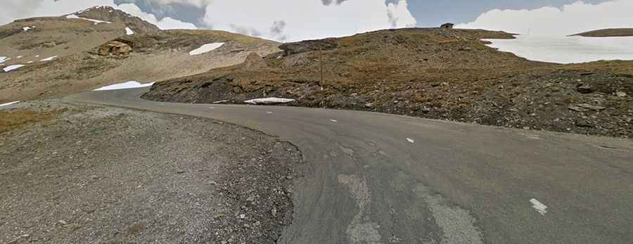
Nestled within the Vanoise National Park, the pass is a bucket-list essential. Known as the King of the Alps and the holy grail for many motorcycle and bike tourers, the pass is wild, intimidating, lonely, and epic. The landscape is desolate, rough, and untouched. It will leave you breathless, and you must experience it.
Can you drive through Col de l'Iseran?
The road to the summit is fully paved, known as D902 road, running north-south from Val d’Isère to Bonneval-sur-Arc.
Is Col de l'Iseran open?
One of the highest roads in the country, this road is open only in summers, from May or June to October. On certain summer days, the road from Val d'Isère to the Col d'Iseran is closed to all traffic except cyclists.
When was the road to Col de l'Iseran built?
The route has existed for hundreds of years as a mule pass and became an official road following a presidential decree in the 1920s, with 600 workers toiling to make the road, which was opened in 1937 by the French president, Albert Lebrun. The col road was constructed between the First and Second World Wars and took an astounding 34 years to complete, finally joining the Maurienne and Iseran valley systems for the first time in history.
Is the road to Col de l'Iseran difficult?
At this elevation, the road is challenging. The north side of the pass road includes several galleries and tunnels, with a maximum grade of 12 percent. Since 1947, the pass has been featured many times in the Tour de France race. On both sides of the pass, milestones mark the distance to the summit, the current altitude, and the slope.