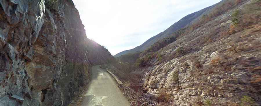
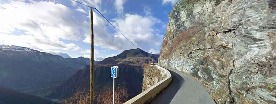
What are the most spectacular Balcony Roads in France? Top 86
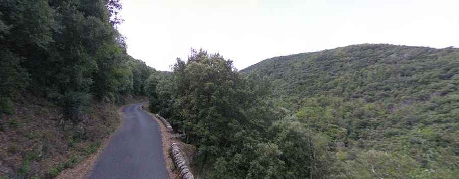
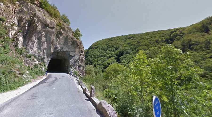
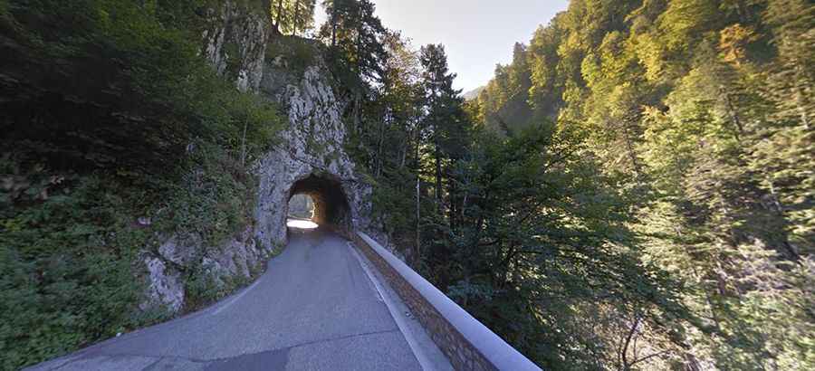
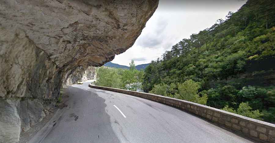
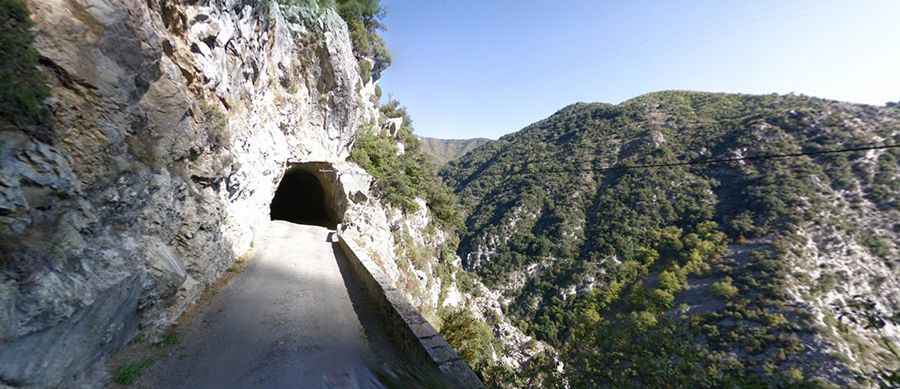
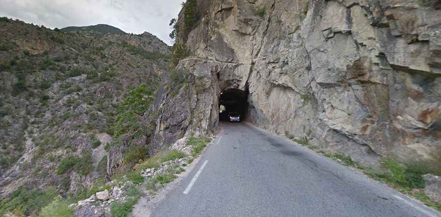
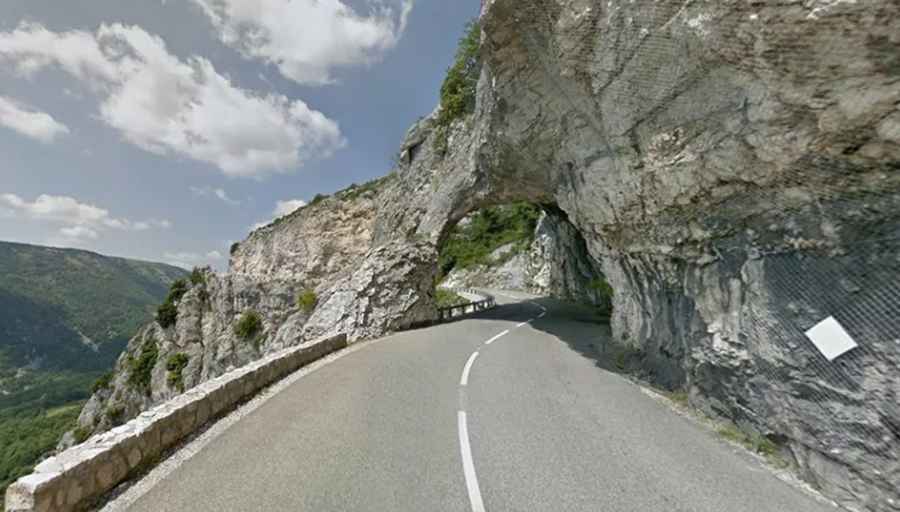
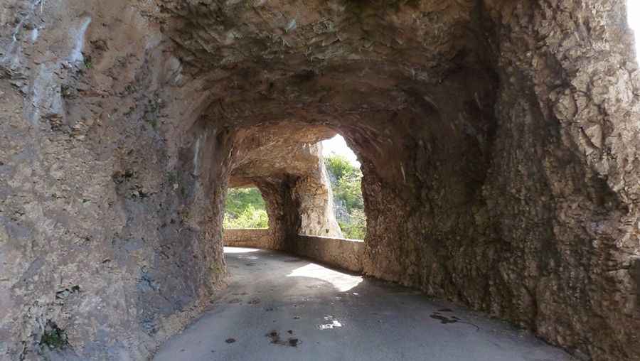
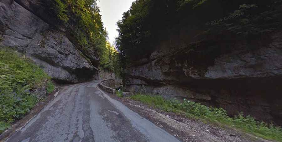
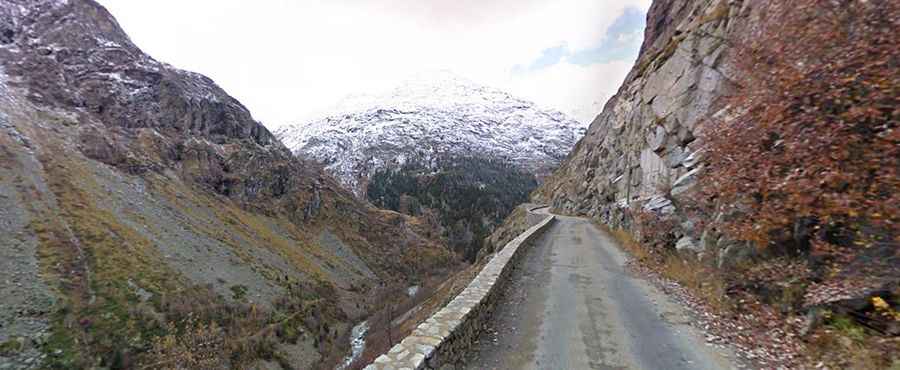
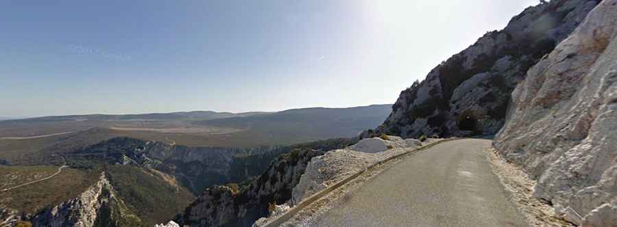
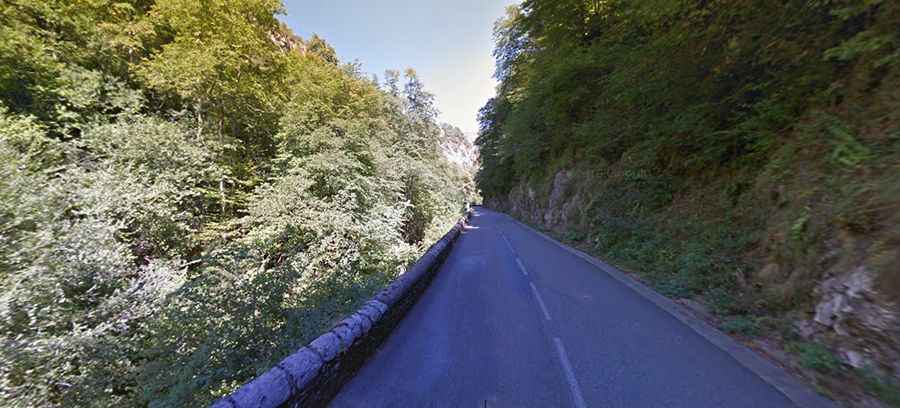
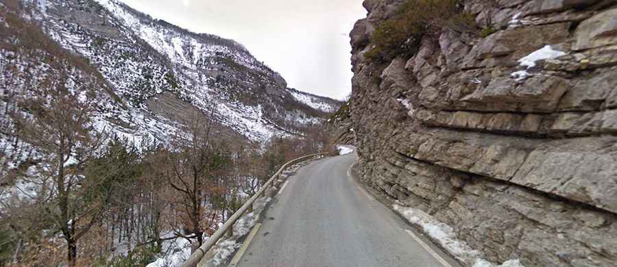
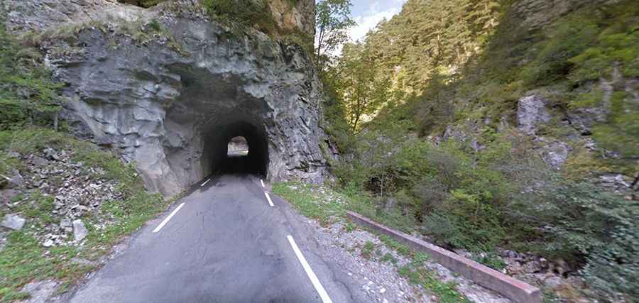
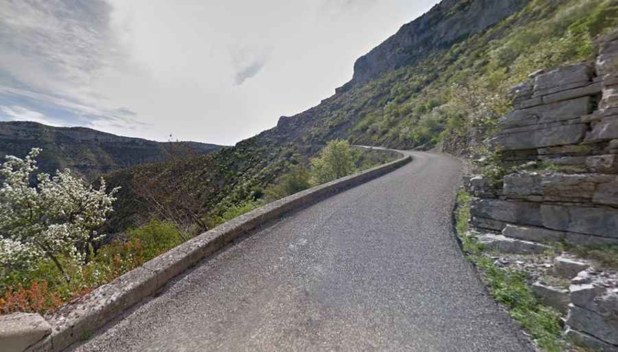
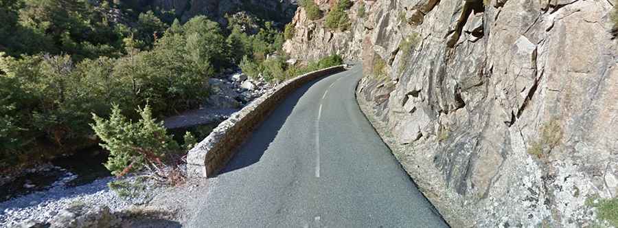
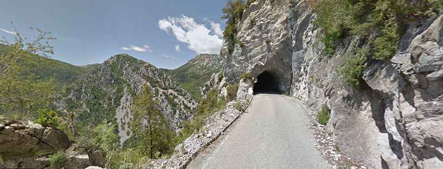
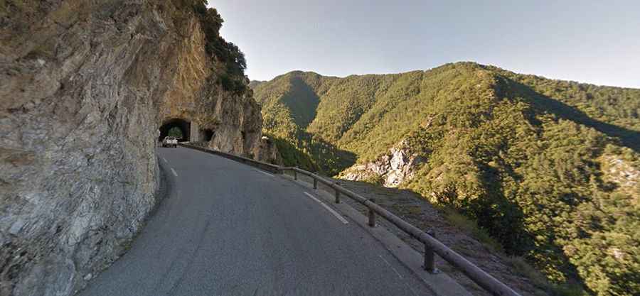
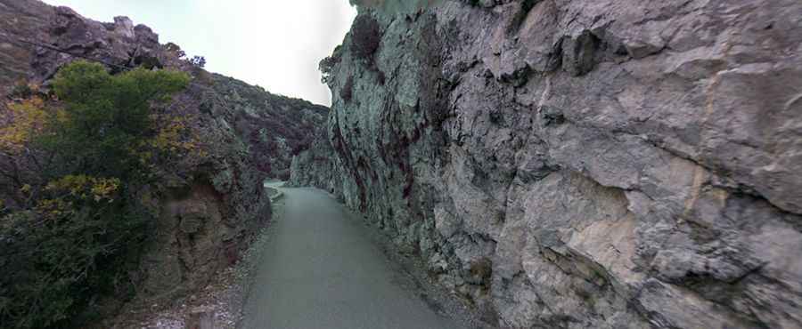
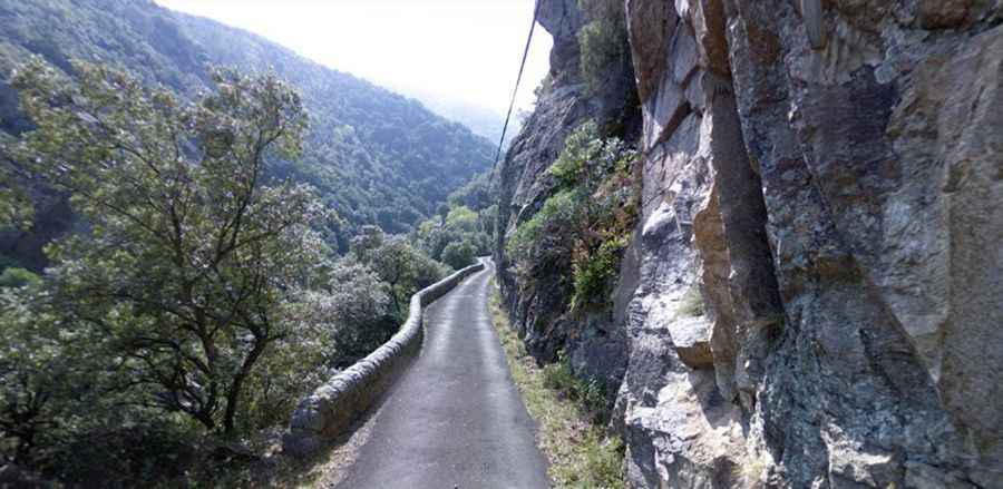
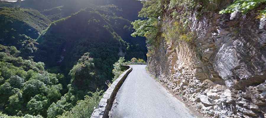
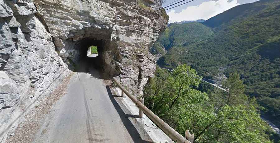
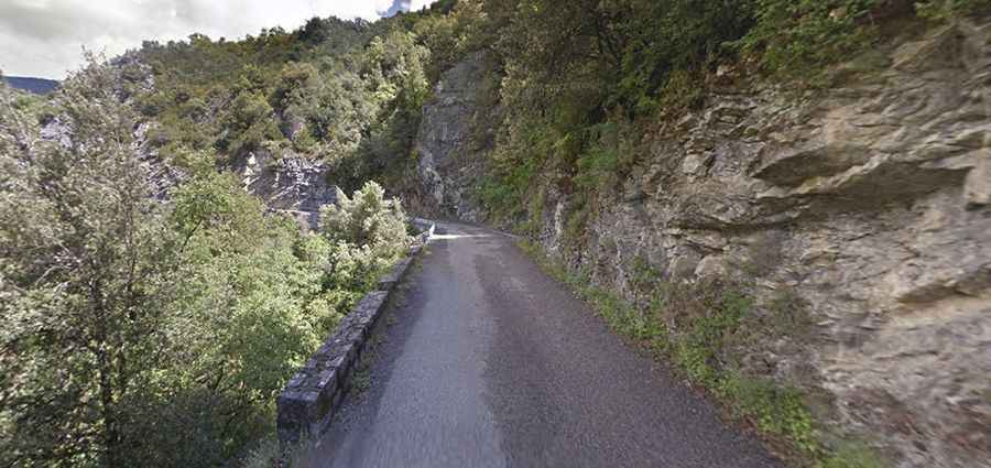
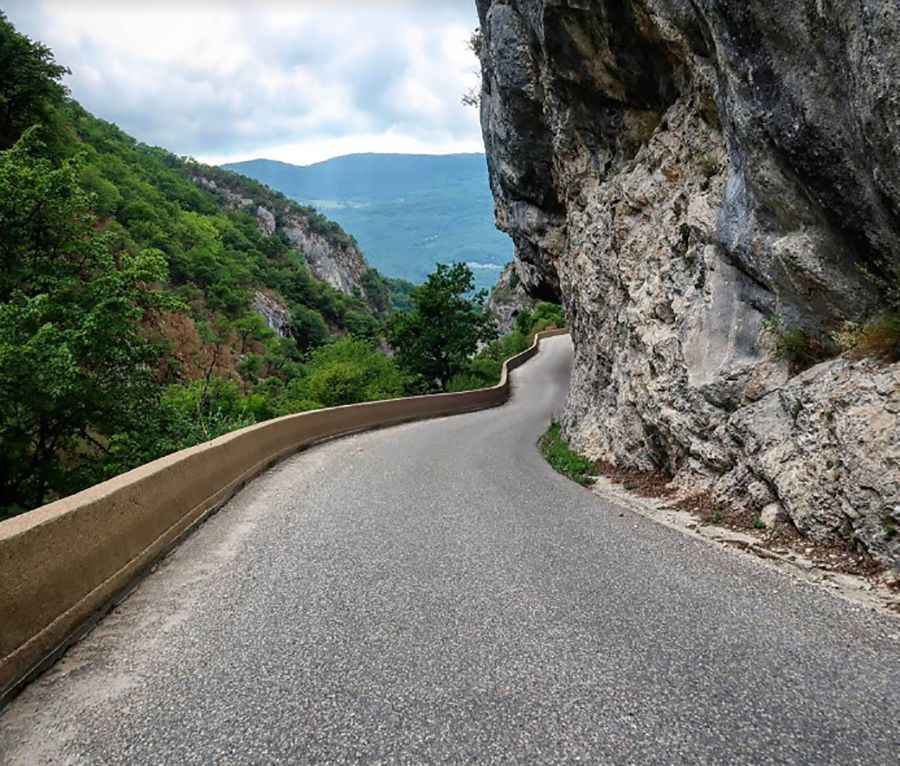
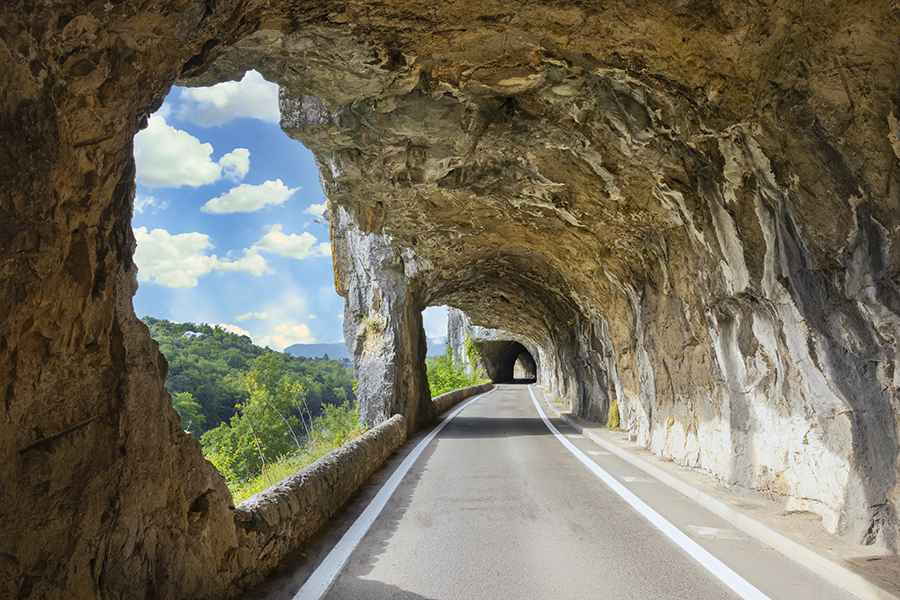
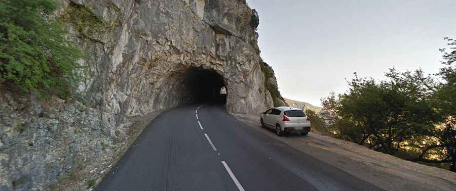
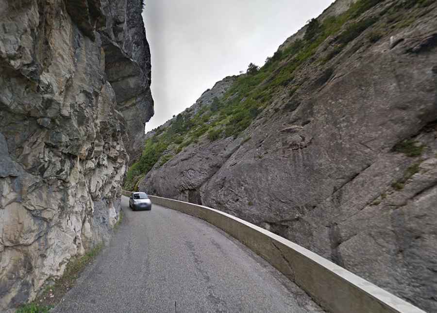
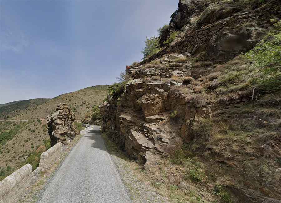
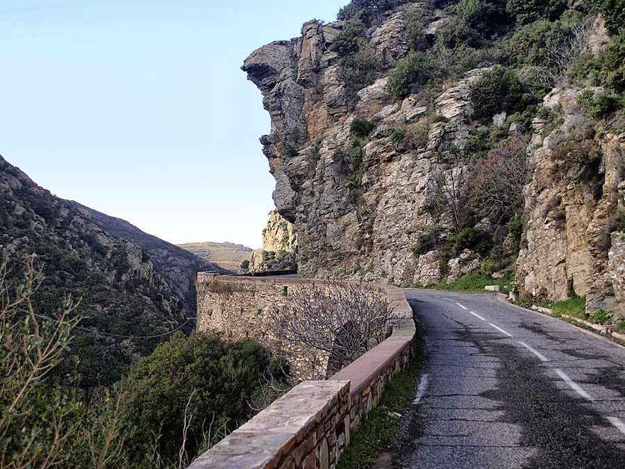
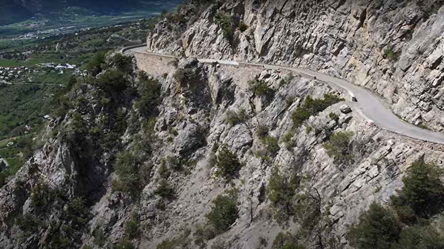
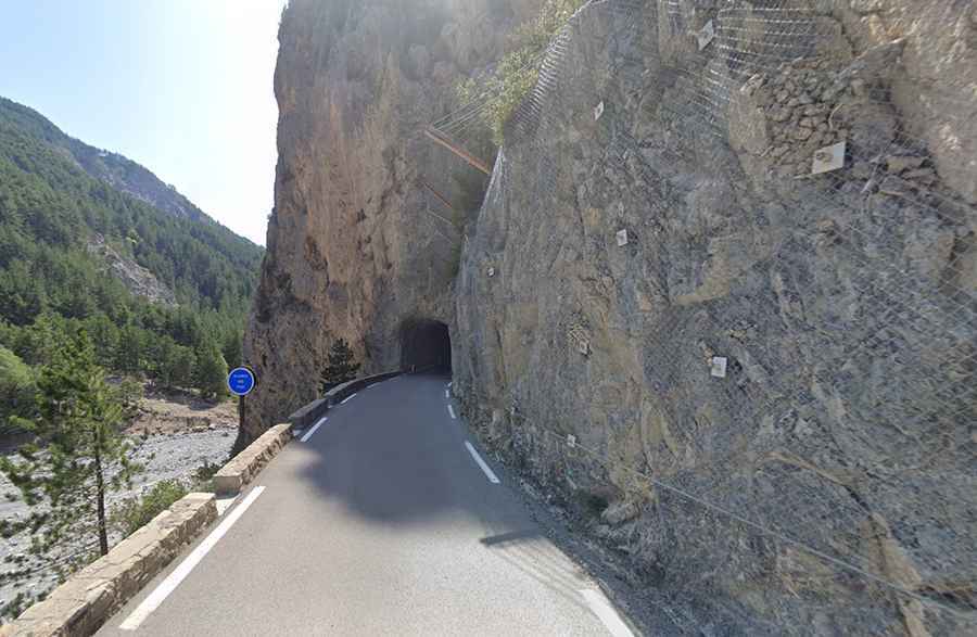
Balcony roads in France are narrow mountain routes carved into steep cliffs, providing passage through rugged terrain while overlooking deep gorges, rivers, and valleys. They are typically winding and include sharp bends, hairpin turns, and tunnels cut directly into the rock. Many sections are single-track, requiring careful attention when encountering oncoming vehicles. Most of these roads are fully paved but restricted to lighter vehicles due to limited width and tight curves.
These roads are primarily located in the Provence-Alpes-Côte d’Azur and Alpes-Maritimes regions, often crossing protected areas such as natural parks. While some remain in use, others have been bypassed by modern tunnels or closed because of landslides, rockfalls, or other safety concerns. Traffic is generally low, making these routes suitable for motorbike riders, cyclists, and travelers seeking scenic and less-traveled roads. If you love these narrow balcony roads overlooking rivers, you might also enjoy discovering the breathtaking canyon roads of Spain, where tiny roads wind through dramatic gorges and river valleys.
In addition to their practical function, balcony roads demonstrate engineering solutions adapted to challenging mountainous terrain. Navigating them requires caution, skill, and respect for the environment. They provide access to remote areas while offering clear views of the surrounding landscapes, making them notable features in the network of French mountain roads.
Where are the most spectacular balcony roads in France?
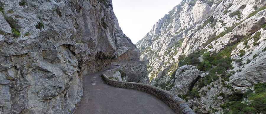
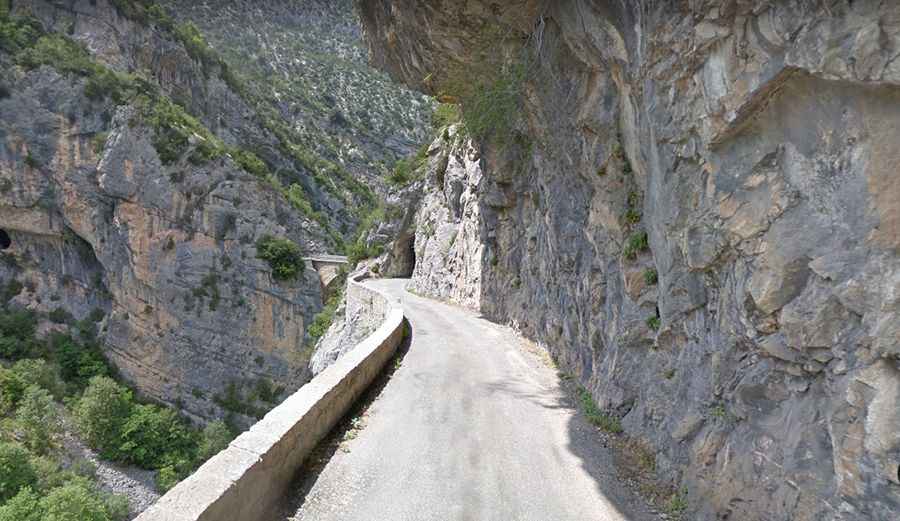
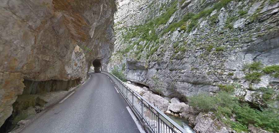
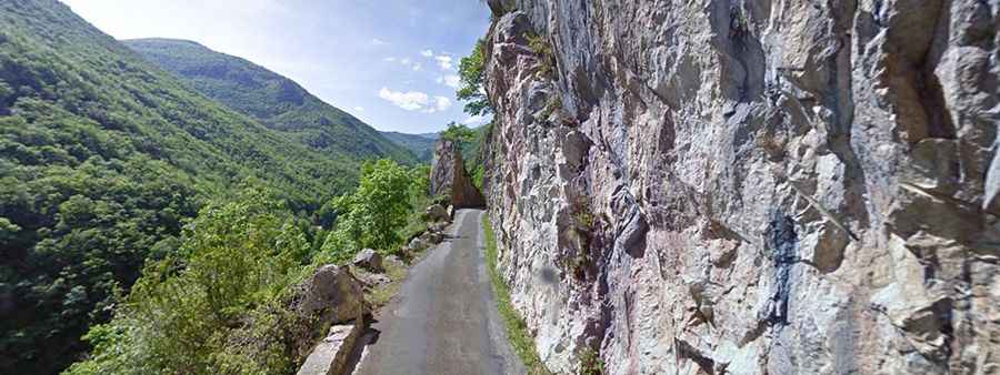
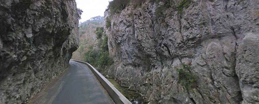
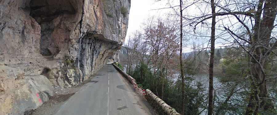
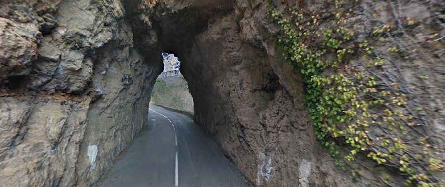
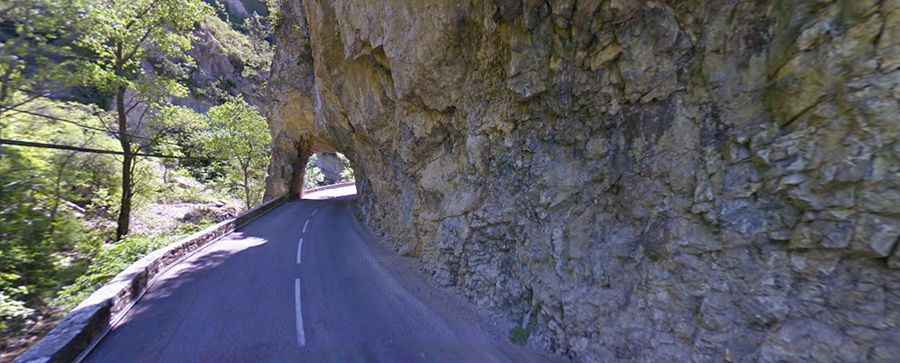
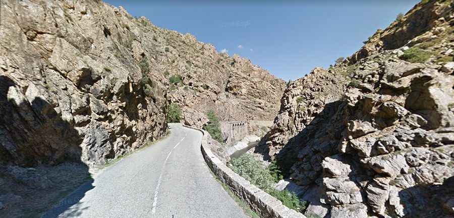
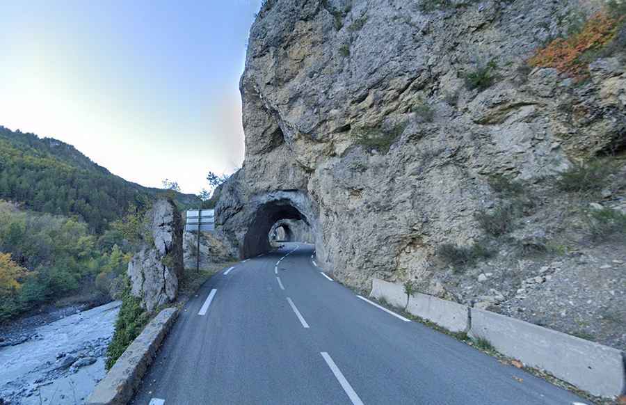
Gorges de Galamus
Gorges de Galamus are located on the border of the department of Aude and Pyrénées-Orientales. The roads to cross the gorges, extremely narrow and dangerous, are D10 and D7, and both become a challenge for car drivers. The gorges are located in the towns of Cubières-sur-Cinoble and Saint-Paul-de-Fenouillet in the Pyrénées-Orientales and have a length of 2km. Crossing the gorges by car is possible all year but in summers the road becomes very busy and the traffic problems are obvious. In July and August there’s a special regulation. Because of the narrowness of the road, it is impossible to turn back.
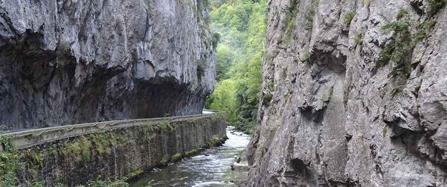
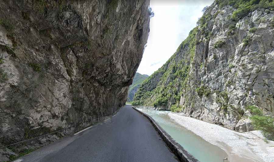
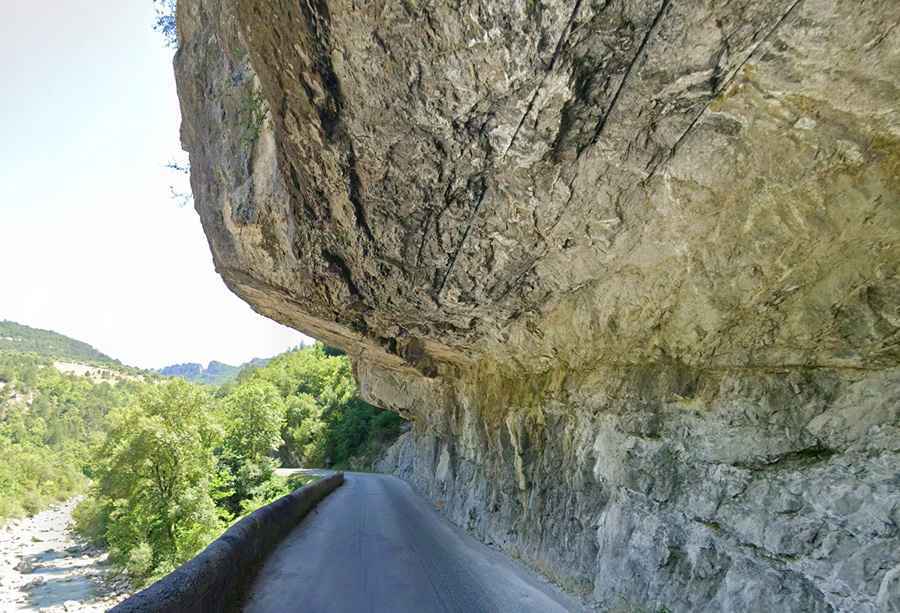
Gorges de la Pierre-Lys
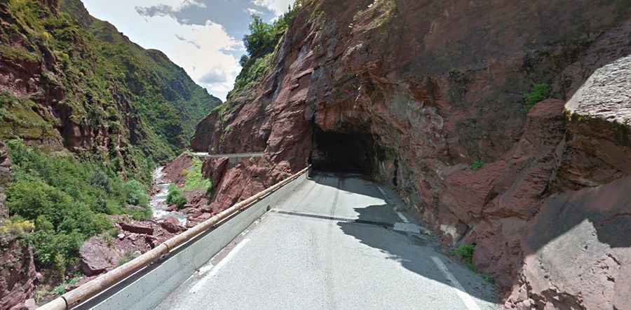
Gorges de la Pierre-Lys are accessed to the south of Quillan, itself south of Carcassonne (Languedoc-Roussillon region). Quillan itself is a pleasant town, but with little in the way of great monuments. It is however well placed to explore both the Cathars castles to the east and the dramatic gorges to the south. The road from Quillan to Saint-Martin-Lys passes through the deep gorge at Pierre-Lys, with cliffs either side of the road stretching to 700 metres in height.
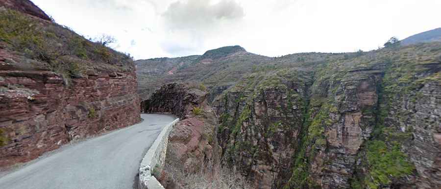
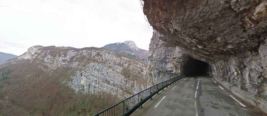
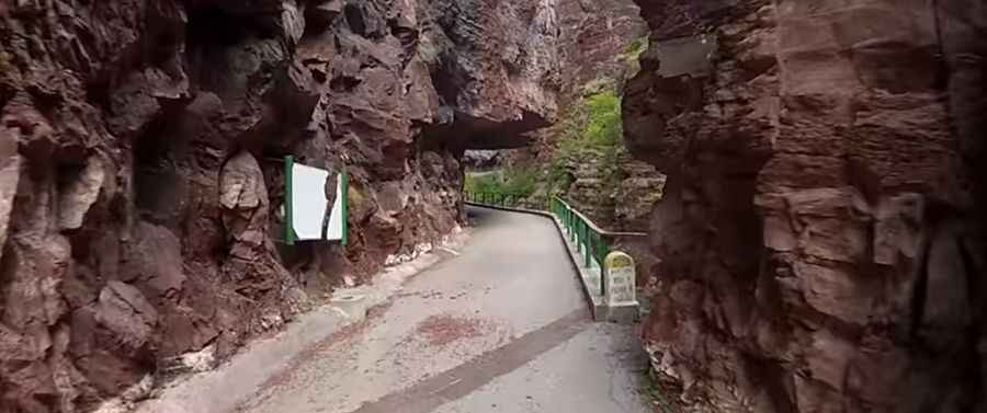
Gorge du Cians
Gorge du Cians is in the East of Gorge de Daluis and a circuit linking both gorges makes an excellent day out, passing through tunnels, past ravines and waterfalls cut into the stunning red rock, and is a photographers dream come true. It's situated in Provence-Alpes-Cote d'Azur, and belongs to the Alpes Maritimes. The deep gorge carved through the mountains by the River Cians is made all the more spectacular by the deep red of the exposed rock. The river descends 1,600 m (5,250 ft) in just 25 km (15 miles) between the villages of Beuil and Touet-sur-Var. The narrowest and most spectacular part of the canyon is at Pra d’Astier, just in the middle between the two villages.

Clue d’Aiglun
Clue d’Aiglun, going by the D10 road, is a very scenic drive, with tunnels and at one point the road follows a narrow ledge cut into the rock. This stretch of road, located in the Alpes-de-Haute-Provence department in the Provence-Alpes-Côte d'Azur region in the southeastern part of the country, should not be attempted by those who don't know how to reverse!
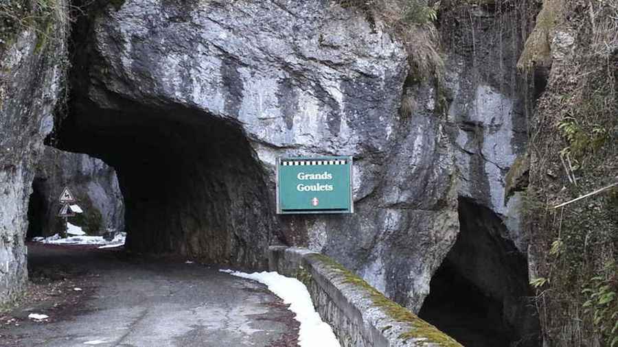
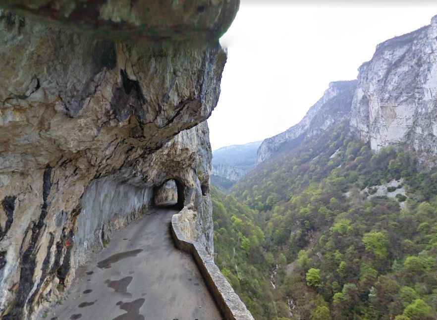
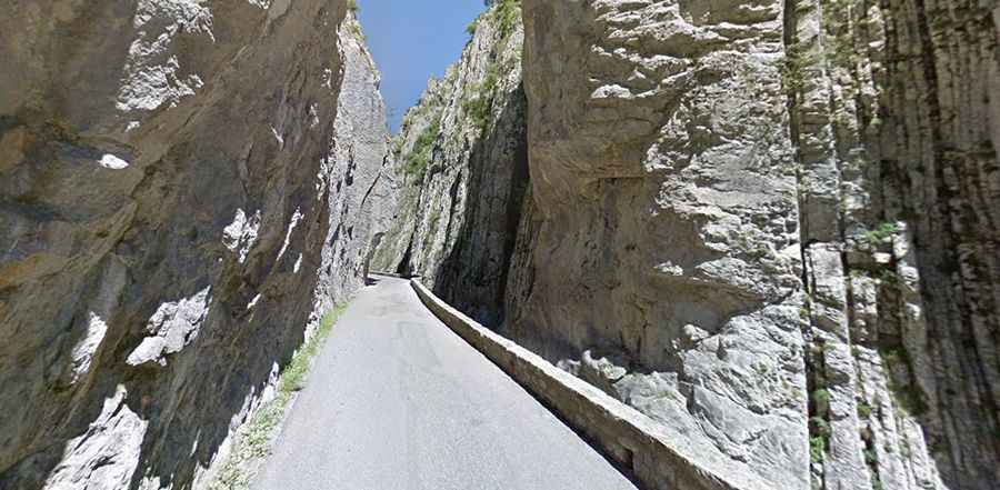
Les Grands Goulets
Built between 1843 and 1854, Les Grands Goulets is a superb route that links the Royans area to the Vercors Central. The construction of this road was a huge human and financial investment. The road is totally paved. This small valley narrows 20 km further above the Vernaison River that turns into a 200 m high waterfall. The road becomes magnificient with the rock just over your head.
Gorges du Nan
A short section of the D22 road, through the Gorges du Nan, with a length of 5.5 miles only, links the towns of Malleval-en-Vercors and Cognin-les-Gorges. This road is located in Vercors national park (Rhone-Alpes), south of Grenoble. This scenic mountain road, with a high climb, is steep, narrow, and can be closed during the winter months. Chains or snow tyres can be required. Due to the landslides, the road can be closed anytime.
Clues de Barles
A short but dramatic stretch of D900a road, from Verdaches to Digne-les-Bains, goes inside the Clues de Barles, a narrow road going through deep canyons. This extremely narrow road is situated in Provence-Alpes-Cote d'Azur and belongs to the Alpes Maritimes.
D219 Road
With a length of 9,9km only, D219 is one of the scariest roads in Europe. Impassable for two cars at the same time, driving this road becomes a challenge, with terrific cliffs in both sides. D219, which is carved into the sheer rock face, brings you up into the high mountains and ends at a picturesque village. A hairpin bend to the left, 8km away from Bourg-d'Oisans, brings into view the course of the lower Vallée du Vénéon, which ends at the Aiguille du Plat-de-la-Selle.
Clue de Saint Auban
Clue de Saint Auban is a spectacular gorge which links St Auban and Brianconnet and has the Esteron River flowing through it. It is situated in Provence-Alpes-Cote d'Azur and belongs to the Alpes Maritimes. The D2211 snakes its way through the clue on a ledge and passes a chapel cut out in the rock where a service is held every September. The narrow and winding, D-2211 is a roller-coaster through forests and mountains to finally climb up to the clue of St. Auban.
Les Ecouges
Built in 1833, this windy wild road of Les Ecouges zigzags up to the village of Rencurel, in the Isère department, in the south-eastern part of the country, before crossing mountain pastures until the Col de Romeyère. The road carries on via the lonely valley des Ecouges, then go though an impressive tunnel dug in the rock at Pont Chabert. The tunnel leads to a road hanging above a waterfall before going down vertignously to the Isere Valley.
Col de la Machine
Col de la Machine is a mountain pass at an elevation of 1.011m above sea level, located near the tip of the remote Combe Laval in the Vercors massif, and is situated in Rhone-Alpes and belongs to the Alps. This pass connects the towns of Saint-Jean-en-Royan and Bouvante, by the D76 road, it is slightly marked and is cut into the steep mountain side and has some nice short tunnels.
Col de la Cayolle
Col de la Cayolle is a high mountain pass at an elevation of 2.326m (7,631ft) above sea level located in the French Alps at the border between the departments of Alpes-Maritimes and Alpes-de-Haute-Provence. The asphalted road over the Col de la Cayolle, located in the Parc National du Mercantour, links the municipalities of Barcelonnette in the Ubaye Valley and Saint-Martin-d'Entraunes. The most scenic part of the road is a narrow section inside the Gorges du Bachelard.
D13 Road
D13 is a short mountain road with a length of 22,7km, located in the Pyrénées-Orientales department in southern France. This curvy mountainous road which rarely permits speeds over 30km/h, is extremely narrow, full of hairpins, and links the communes of Maureillas-las-Illas and Llauro in the Pyrénées-Orientales department in the southeastern part of the country.
Gorges de la Nesque
Gorges de la Nesque are located in the Vaucluse Mountains, a mountain range of the French Prealps located in the departement of Vaucluse, between the Luberon Massif and Mont Ventoux. The gorges are traversed by the D942 road. The road is certainly breathtaking and it has a fearsome reputation. The Nesque Gorge road is very popular with cyclist and is fairly traffic free thanks to the numerous low tunnels that you have to pass through. The small Nesque river runs down through the gorges and valleys from near Sault, where it's at 620 m, to an area between Villes-sur-Auzon and Methamis, where it drops down to about 300 m.
Gorges de Chouvigny
Gorges de Chouvigny is a canyon located in the Allier department. The gorge is carved by the La Sioule river. It’s traversed by the D915, a 7.4 km long narrow road linking the towns of Le Pont de Menat and Chouvigny.
Clue du Riolan
The Clue de Riolan is one of France's most beautiful canyons. Located in the Alpes-Maritimes department in the southeastern part of the country, the canyon is carved by the Le Riolan river. It’s traversed by the D17 road. It’s 11.4 km long and links the towns of La Combe and Roquesteron. This amazing road is located in the Vallée de l'Esteron (Esteron River Valley).
D29 Road
D29 is a short mountain road located in the Aude department in the southeastern part of the country. It’s 2.7 km long starting from Fontanès-de-Sault. The road climbs up several mountain passes up to 1.000m. Along the way there are several unlit tunnels. Totally closed to vehicles higher than 2.7 meters.
Gorges de la Blanche
Gorges de la Blanche is an amazing gorge located in the Alpes-de-Haute-Provence department in the southeastern part of the country. The road through the gorges is called D900C and follows a river called La Blanche. The surface of the road is in bad conditions and there’s a strong risk of rockfalls. The road links the towns of Espinasses and Selonnet. It’s 3,8m high and 9m wide in some sections.
Gorges du Guiers Mort
The Gorges du Guiers Mort is a canyon formed by the Guiers Mort river in the Isère department in the southeastern part of the country. The gorges are traversed by the D520B road, also known as Route du Désert. The gorges are located on the route between La Diat and Saint-Laurent-du-Pont.
Clue de Carajuan
Located in the Alpes-de-Haute-Provence department, in the southeastern part of the country, the Clue de Carajuan, a place where the river breaks through a band of limestone and is pushed into a short canyon, is called Route Departementale D952 and links the villages of Castellane and Palud-sur-Verdon.
Clue de la Maglia
Clue de la Maglia is a very scenic drive located on the isolated valley of Maglia River near the village of Breil-sur-Roya in Alpes-Maritimes department in the southeastern part of the country. The surface of the road, with the Maglia river sparkling deep below in the canyon, is mostly asphalted, with some gravel sections near the end. Speed limit is 30 km/h. The road is extremely narrow, totally impassable for 2 cars at the same time. It’s a wonderful and very amusing canyon digged in the white limestone of the Vallèe de la Roya.
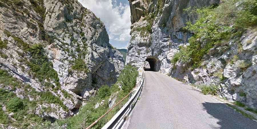
Gorges du Guil
Gorges du Guil are a picturesque, deep and narrow gorge slices through black rock shot through with bright patches of colour located in the Hautes-Alpes département, in the southeastern part of the country. The road to cross the gorges is called D902. It's asphalted but extremely narrow. There are several tunnels. The Gorges du Guil provide a gateway to the Queyras and are truly impressive.
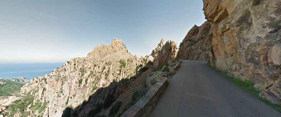
D81 Road-Calanques de Piana
D81 road through the Calanques de Piana is one of the great drives of Europe. It’s located on the west coast of Corsica. Located in the gulf of Porto, this 11,7km section goes through a spectacular landscape of red granite cliffs and spiky outcrops, carved into bizarre shapes by the forces of wind and water. Between Porto and Piana, this narrow road winds against the magnificent red granit faces that plunge into the sea. These are the "Calanques of Piana". Engraved by the erosion, they look like a fantastic sculpture.
Clue de Gréolières
Clue de Gréolières is a very scenic canyon located in the heart of the Alpes-Maritimes department. Set high on the Alpes Maritimes, the road through the gorges, carved by Le Peyron river, is totally paved. It’s called D2 (Route de Thorenc or Route de Gentelly). The road climbs up to Pas de Tous Vents, a high mountain pass at an elevation of 1.052m (3,451ft) above sea level. The road is stunning and dramatic, and features a series of narrow and unlit tunnels perched on a road carved into the rocks. The road has an extraordinary appeal. So much so that the street even made it into the James Bond film – Goldeneye for the car chase scene..
Gorges de Daluis
The Gorges de Daluis are a deep, narrow gorge on the upper Var river located in the Alpes-Maritimes department in the southeastern part of the country. The famous gorges are a six-kilometer-long canyon formed by the river Var within the D2202 road, running south from Guillaumes to Daluis.It’s at its best during the winter thaw when the melted snow swells the river to offer adventurers a maximum adrenalin rush and long lasting memories.
D220 Road-Les Travers
D220 is a short mountain road located in the Isère department in southeastern France. The road is fully paved but extremely narrow. It’s 5,7km long. The road, known locally as Les Travers, is made difficult by single track sections and overhanging rock, and is impassable to heavy vehicles.
Combe de la Fayolle
Combe de la Fayolle is a very daunting ravine located in the Isère department in the Auvergne-Rhône-Alpes region, in the southeastern part of the country. The scary road through the ravine is called D211A. It’s also known as Auris balcony road or Route de la Roche. Carved into the mountainside, the road is totally paved but extremely narrow. The road is 15.9km long.
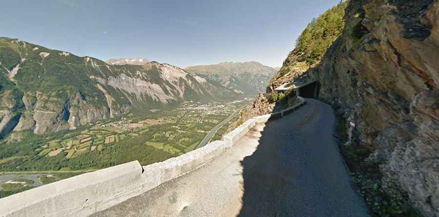
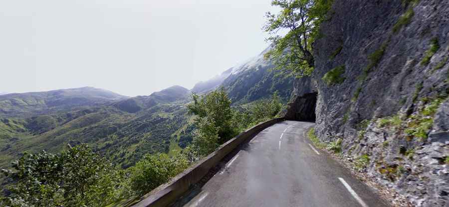
Combe Laval
Frequently recognized as the most magnificent road in the French Alps, this road through Combe Laval was constructed between 1861 and 1898 and originally served for the transportation of timber from the Forêt de Lente to St-Jean-en-Royans. Right now it mainly attracts cyclists eager to face the challenge of a steep climb and be rewarded with awe-inspiring views of the Vercors region. The most spectacular stretch of the road, between St. Jean-en-Royans and Col de la Machine, cuts into the cliff-like side of the gorge and runs via a series of short, narrow tunnels. Nearly 8 mi (13 km) of lush, alpine beauty and dizzying heights. To go through this road, at Saint Jean en Royans, take the D 76 at the end of the village, direction Col de la Machine.
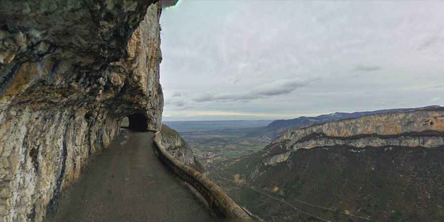
Route de Presles
Route de Presles is a stunning mountain road located in the Isère department in the southeastern part of the country. The road is 7km long, carved into the mountains. Words can’t describe the road and pictures don’t do it justice. The road is called D292. It’s a succession of open tunnels and passages, carved directly into the rock, resulting low and narrow lanes, blind corners and potential landslides.
Gorges de la Bourne
Gorges de la Bourne is a canyon formed by the Bourne River, located in the Vercors Massif, in the départements of Isère and Drôme in the French Prealps. The gorges are traversed by the RD 531 road. The gorges are located on the route between Pont-en-Royans and Villard-de-Lans, two municipalities in the Isère department in the south-eastern part of the country.
Route de la Bérarde
Route de la Bérarde is a legendary drive located in the Isère department in the south-eastern part of the country. The road is D530. It’s 27.4km long and is fully paved. This road was opened to vehicles in 1921.
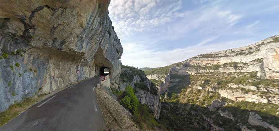
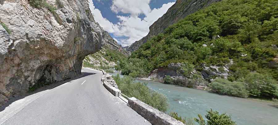
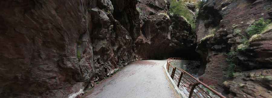
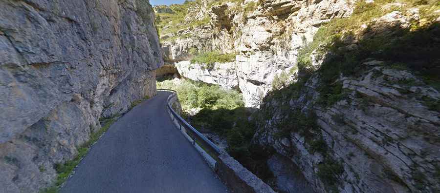
Gorges du Verdon
Nicknamed the ‘Grand Canyon of Europe’, the Gorges Du Verdon is one of the most spectacular sites in the world. Located in the south-eastern part of the country, a narrow road was carved out of the cliff high above the green river. It’s a hair-raising drive: a sheer vertical drop of more than 2,300 feet, in many places too narrow for two-way traffic, with craggy rock overhangs, blind curves and hairpin turns, and thrillingly, no guardrail. The gorges, also called the Grand Canyon du Verdon, is a river canyon that is often considered to be one of Europe's most beautiful, forming a border between the Alpes-de-Haute-Provence and the Var.
Gorges du Guiers Vif
Gorges du Guiers Vif is a very scenic canyon located in the Isère department in the southeastern part of the country. The road through the gorges, also known as Gorges du Frou, is called D520C, also known as Route des Entremonts. The road is 11.8 km long.
D43 Road
Located in the Lot department in the south-western part of the country, the D43 Road is a thrilling experience. The road is asphalted. It’s 2.4km long and links Le Colombier and La Tuilerie. The most challenging part of the road runs along the Dordogne river. It runs as a single track road along the mountainside for some distance with nowhere to pass another vehicle.
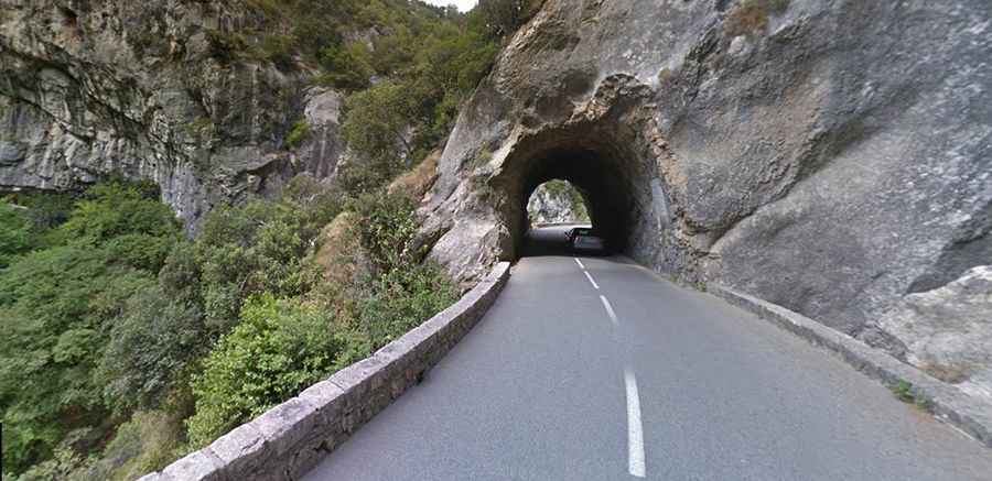
Gorge du Loup
Gorge du Loup is a stunning gorge which starts high in the hills above Greolieres and continues down to Pont-du-Loup, from where you can look up and see Gourdon perched on the cliffs high up above. Located in Provence-Alpes-Cote d'Azur, in the Alpes Maritimes, the road that crosses the gorges is called D6 (or Route des Gorges du Loup). The road is cut in the rocks, with some tunnels. Along the route you will find numerous cascades and deep pools, and some well-known high jumps.
D918 Road
D918 is an extreme high mountain road located in the Pyrenees. The winding asphalted road is 45.0 km long. It connects the town of Laruns, in the valley of the Gave d'Ossau, via Eaux-Bonnes (west) and Argelès-Gazost, in the valley of the Gave de Pau, via the Col du Soulor (east). This road is generally closed from December to June. Its highest elevation is Col d'Aubisque, at 1.709m (5,607ft) above sea level.
Gorges du Hourat
D943 road through the Gorges du Hourat is one of the great drives in the south-western part of the country. The surface of the road is asphalted and is very narrow.
Gorges de la Méouge
Gorges de la Méouge is an incredible canyon located in the Hautes-Alpes department in the southeastern part of the country. The gorge is 7-kilometre (4.3 mi) long carved by the Méouge which has its source in the Drôme. This real gem of a discovery located within the Baronnies Provencales Natural Regional Park, is traversed by the D942, a small asphalted narrow road. It’s 10.0 km long and links the towns of Le Plan and Barret-sur-Méouge.
Gorges des Gats
Gorges des Gats is an incredible canyon located in the Drôme department. The gorge is carved by the Ruisseau des Gats river. It’s traversed by the D539. It’s 10.2 km long and links the towns of Châtillon-en-Diois and Glandage. The road was built in 1865. There are 5 unlit tunnels along the road. The gorge is famous for its bewildering network of subterranean caves, a few of which are open to the public.
Cirque de Navacelles
Cirque de Navacelles is a deep, steep-sided canyon located in the Occitanie region in the southern part of the country. The cirque was once created by the River La Vis. It’s traversed by the D130 and D713. It’s 10.2 km long and links the towns of Blandas (in the Gard department) and Saint-Maurice-Navacelles (in the Hérault department). This geological spectacle in a beautiful environment, offers a great geologic experience. The canyon was formed long ago when a meander of the river Vis carved it into the limestone of the Causse plateau. Today, the river has dried up, leaving a wonderful spectacle of nature.
Gorges de Saint-Georges
Gorges de Saint-Georges is a canyon formed by the Aude River, in the Occitanie region, in the southern part of the country. Located within the Pyrenees, the gorges are traversed by the D118 road. The road is stuck between two huge rocky walls and the river Aude.
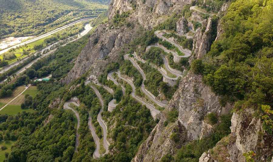
Col du Chaussy
Col du Chaussy is a mountain pass at an elevation of 1.533m above sea level, traversed by the D77B road, in south-eastern France. It's an improbable road clinging to the edge of the cliff. Dating from 1934, Col du Chaussy is probably best known for the 17 truly unbelievable hairpins at the start – the “lacets de Montvernier.” But beyond this it’s a big climb with more than 1000 metres of ascent.
Clue de la Roche Percée
Clue de la Roche Percée is a very scenic drive located in the Alpes-de-Haute-Provence department in the southeastern part of the country. Driving on this narrow road between walls of cliffs and gorges is a delight. The road is called RD4085 (formerly known as RN 85). The road climbs up to 1.071m above the sea level.
Clue de Chasteuil
Clue de Chasteuil is located in the Alpes-de-Haute-Provence department in the southeastern part of the country. The road to the clue, a place where the river breaks through a band of limestone and is pushed into a short canyon, is called Route Departementale D952 and links the villages of Castellane and Palud-sur-Verdon.
Passage de la Petite Clue
Located in the Alpes-Maritimes department in the southeastern part of the country, Passage de la Petite Clue was totally closed to motor vehicles after the construction of a tunnel. Part of the old D-28 road, this narrow piece of asphalt is located on the parking just before the Tunnel de la Petite Clue. It's 457.71 m (1,501.66 ft) long.
Passage de la Grande Clue
Located in the Alpes-Maritimes department in the southeastern part of the country, the Passage de la Grande Clue was bypassed by a tunnel and totally closed to motor vehicles. Part of the old D-28 road, this narrow piece of asphalt is 500m long. Landslides, rock falls and mudslides can occur anytime and can sometimes block some sections of the road. Fallen rocks are found at the road.
Clue du Pérouré
A short but dramatic stretch of the D900a road, from Verdaches to Digne-les-Bains, runs through the Clue du Pérouré, a narrow road going among deep canyons. This extremely narrow road is situated in Provence-Alpes-Cote d'Azur and belongs to the Alpes Maritimes. Along the road there are several signs about the limited maximum height of the road, ranging from 2,8m to 3,2m.
Les Détroits
Located in the Lozère department in the southern part of the country, Les Détroits is a thrilling driving experience. The road is called D907BIS. It’s 11.3 km long and links the villages of La Malène and Les Vignes. The most challenging part of the road runs along the Tarn river. It’s certainly breathtaking and it has a fearsome reputation. Maximum height is limited to 3.8m.
Gorges de l’Asco
Gorges de l’Asco is an incredible defile located in the Haute-Corse department in the Corsica region. The gorge is carved by the Asco river. It is traversed by the D147, a thin asphalted road following the winding course of the river. It’s 11.6 km long and links the towns of Moltifao and Asco. It's in good condition but with no guard rails and basically one lane. It's located in the valley of Asco inside of Parc naturel régional de Corse.
D22 Road
Perched high above the glistening coastline of the Côte d'Azur in the southeastern part of the country, the D22 Road is fully asphalted. Many of the corners are sharp and blind. If you're afraid of heights, it's probably best to keep your eyes forward. The whole road is very steady and basically there is no place to get any rest. This narrow winding road climbs up to Col de Bausson (732m), Col de la Madone de Gorbio (927m) and Col de Saint-Pancrace (673m). There are also 5 unlit one-lane tunnels cut into the rock. It was used by Lance Armstrong, Tony Rominger, Chris Froome and Richie Porte to test their fitness in the run up to the Tour de France.
Col de Turini
Col de Turini is a mountain pass at 1.607m (5,272ft) above sea level, in the Alps. Helter skelter corners and changeable weather conditions mean this road is far from safe. Lethal in bad weather, this road can often be covered in snow and ice making it one of the most treacherous roads in the world. Hugging the mountainside, and going through it, up through the trees, the road becomes more challenging, with hairpin bends a plenty, rock on one side and drops on the other, the top section is extremely twisty, with rocks sometimes in the road, not a road to lose concentration on.
Gorges de Padern
Gorges de Padern are located in in the Aude department in the southern part of the country. The gorges are traversed by the D123 road. Be careful in the curves. The gorges were carved by the Le Torgan river. The water flows in a succession of cascades, potholes and small lakes which have been naturally crafted in the rocks.
D662 Road
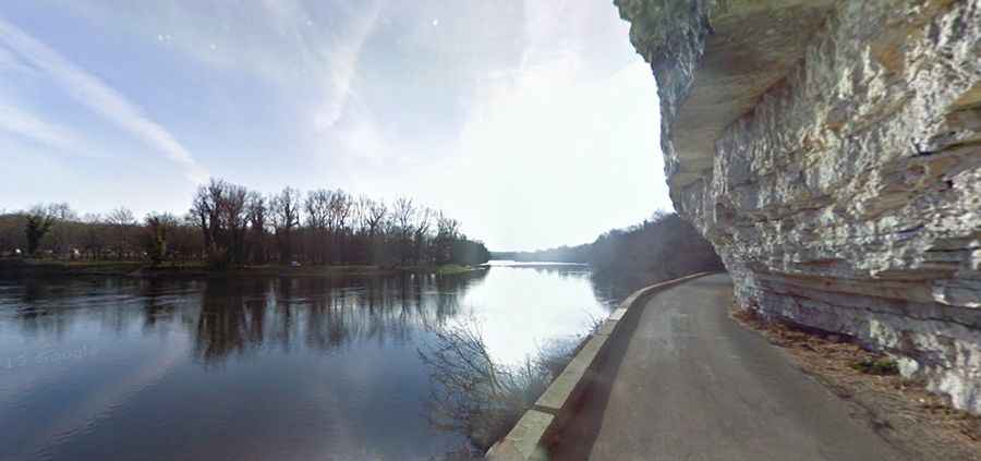
Route Départementale D662 is located in the Lot department in the south-western part of the country. The road is asphalted. It’s 30.2 km long and links the villages of Saint-Géry and Cajarc. It’s pretty quiet. It runs along the shore of the Lot River. Recommended to small vehicles (4,1 meters height limit). It’s a pleasant ride above the Lot River with manageable elevation gain. Fast flowing so drive carefully.
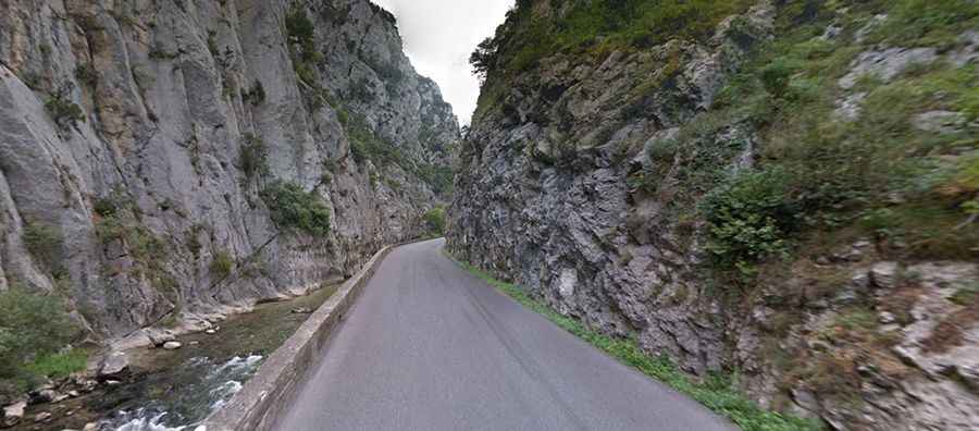
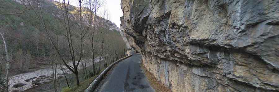
Gorges de l'Aude
Located in the Aude department in the southern part of the country, Gorges de l'Aude is a narrow canyon to the south of Quillan, itself south of Carcassonne. The road through the gorges is the challenging D118, with some narrow parts. Walking and cycling are recommended because the narrow roads will require much of your attention, and you will see less of the scenery from the car window. The canyon was carved over time by the River Aude, hurtling down the slopes of the Pyrenees.
Gorges de Rebenty
Gorges de Rebenty is a very scenic canyon located in the department of Aude, region Languedoc-Roussillon. The drive is very lovely but can also be very challenging if you are driving. The most treacherous, narrowest and deepest part of the drive is a short section known as Défilé d'Adouxes. It’s 2.4 km long, running from the town of La Fajolle towards Mérial.
Défilé de Joucou
Défilé de Joucou is a very narrow canyon located in the department of Aude, region Languedoc-Roussillon where even the road barely fits. Located up the valley of the Rebenty, the tiny road through woods is totally paved, but very narrow. It’s called D107. At some places, the road is cut out of the rock leaving the overhanging rock as a kind of roof. The canyon is also known as Défilé d'Able. Themost treacherous, narrowest and deepest part of the drive is a short 4.7km long section running from the town of Joucou towards Belfort-sur-Rebenty. Height limit is 3.5 meters. The road runs through a few unlit tunnels.
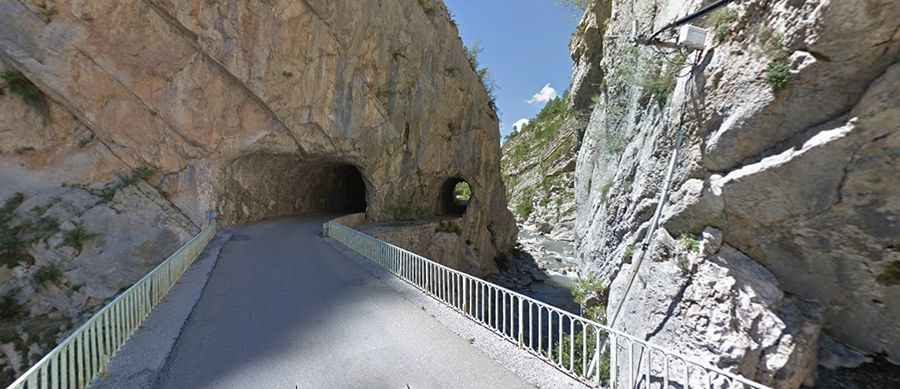
Gorges du Tarn
Gorges du Tarn is a canyon formed by the Tarn River, located to the north of Millau, in the Lozère department of the Massif Central, northern Langudoc-Roussillon. The gorges are traversed by the paved D907bis road. This scenic drive follows alongside the gorge and it has lots of stopping places, although not always in quite the place that you want to stop. The riverside road is notorious for summer traffic jams. It’s narrow and not recommended to large vehicles. The tunnels and rocky overhangs along the route will be hazards to negotiate with care.
D102 Road
D102 is a narrow paved road located in the Alpes-de-Haute-Provence department, in the region of Provence-Alpes-Côte d'Azur. The road runs through a canyon carved by the Rayaup river. The road is 10.9km (6.77 miles) long, running north-south from Castellane to Le Bourguet. Vehicles towing a caravan and trucks are forbidden.
Gorges of Terminet
Clue du Terminet is a challenging canyon formed by Le Sou river in the Aude department. The gorges are traversed by the D40 road. It’s totally paved and runs along a narrow canyon carved by Le Sou River. The road winds as a river, cutting snakes into the cliffs and passes through two tunnels. The road was constructed in 1903.
Gorges d'Omblèze
Gorges d'Omblèze is a defiant canyon carved into the limestone by La Gervanne river in the Drôme department. The gorges are traversed by the meandering D578 road. It’s totally paved and runs along a narrow canyon carved by La Gervanne river. High risk off rock slides.
Gorges de Trente-Pas
Gorges de Trente-Pas is a spectacular canyon carved into the limestone by Ruisseau de Trente-Pas river in the Drôme department. The gorges are traversed by the meandering D70 Road. It’s totally paved and runs along a narrow canyon carved by Ruisseau de Trente-Pas river. High risk off rock slides. Located at heart of the Drôme Provençale, completely surrounded by mountains and forests, the staggering road is 12km (7.45 miles) long, running north-south from Bouvières to Saint-Ferréol-Trente-Pas.
Route Du Pas de la Confession
Located in the Isère department, in the Auvergne-Rhône-Alpes region, Route Du Pas de la Confession is a very challenging drive. The road is so defiant that travelers were encouraged to make confession before using it. Nestled in the French Alps, the road is called D211B. It’s totally paved but extremely narrow. The cliff road is 3.5 km (2.17 miles) long, running east-northwest from Huez to Villard-Reculas. Until 1980 this only road served Villard Reculas. Then the town was opened up with the road that links Allemont.
Gorges de la Cadière
Gorges de la Cadière is a canyon formed by the Argentesse river, located in the Gard department, in Occitanie region. The gorges, also known as Gorges de l'Argentesse, are traversed by the D296 road. The road is 6.0 km long, running south-north from La Cadière-et-Cambo to Cambo.
Gorges de Nouailles
Gorges de Nouailles is a canyon formed by the Loue River, located in the Doubs department in the Bourgogne-Franche-Comté region, in the eastern part of the country. The gorges are traversed by the D67 road. The road was dug into the side of the limestone rocks that border the gorges. The road is 6.6 km long, running east-southwest from Mouthier-Haute-Pierre to Saint-Gorgon-Main. This cliff road is totally paved. Inaugurated on August 10, 1845, under the reign of Louis-Philippe, the road offers breathtaking views of the gorges and many lookouts allow a stopover to appreciate the wild beauty of this valley.
Gorges du Terme Inférieur
Gorges du Terme Inférieur is the name of a very challenging canyon located in the Pyrénées-Orientales department of the region of Occitanie, in the southern part of the country. The road through the gorges is totally paved running along a narrow canyon carved by the Mondony river. It’s called D53 and D53B.
D428 Road
Vallon de Pierlas is the name of a very scenic valley located in the Alpes-Maritimes department, in the Provence-Alpes-Côte d'Azur region. The road through the valley is totally paved, with countless hairpin turns dug into the rock. It’s called D428 Road. The road is 7.3km (4.53 miles) long, running from Pierlas to D28 road (Gorges du Cians). It features very steep sections, hitting a 26% of maximum gradient through some of the ramps.
M59 Road
M59 is the name of a very scenic yet challenging road located in the Alpes-Maritimes department, in the Provence-Alpes-Côte d'Azur region. The road is totally paved, with countless hairpin turns, narrow bridges and tunnels dug into the rock. The road is 11.0 km (6.83 miles) long, running from M2205 road to Ilonse.
Col de la Madone
Col de la Madone is a mountain pass at an elevation of 1.165m (3,822ft) above sea level, located in the Alpes-Maritimes department, in the Provence-Alpes-Côte d'Azur region. The road to the summit is totally paved, with countless hairpin turns and narrow bridges. It’s called D226, also known as Route de Thiéry. The road is 13.8 km (8.57 miles) long, running from Villars-sur-Var to Thiéry.
Gorges de la Ruda
Gorges de la Ruda is a canyon located in the Haute-Corse department of France on the island of Corsica. Tucked away in the center of the island, the road through the gorges, carved by the Ruda river, is totally paved. It’s called D84. It’s a very beautiful route through the enclosed gorges of La Ruda.
M6202 Road
Tucked away in the southeastern part of the country, the M6202 Road is totally paved. Part of the Route de Grenoble, the road is narrow and features countless tunnels dug into the rock. Running along the Var River, the most scenic part of the drive is 31km (19.26 miles), from Var Bridge (Pont sur le Var) to Nice, the capital of the Alpes-Maritimes department on the French Riviera. High risk of landslides.
Gorges d'Aulan (le Toulourenc)
Gorges d'Aulan is a canyon carved into the limestone by the Toulourenc river in the Drôme department of Auvergne-Rhône-Alpes region. Nestled high in the Toulourenc valley at the foot of the Mont Ventoux, the gorges, also known as Gorges du Toulourenc, are traversed by the meandering D159 road.
Gorges de la Vésubie
Gorges de la Vésubie is a canyon located in the Alpes-Maritimes department in the region of Provence-Cote d'Azur. Tucked away in the southeastern part of the country, the canyon was formed by erosion of the Vesubie river, a tributory of the Var river flowing into the Mediterranean Sea at Nice. The scenery is great and spectacular views are guaranteed. The gorges are traversed by the paved M2565, nicknamed as Route de la Vésubie. The narrow road that skirts the Vésubie river is 20km (12 miles) long, linking the M173 and M6202 roads.

Route de Duranus
Located in the Alpes-Maritimes department in the region of Provence-Cote d'Azur, Route de Duranus is totally paved. It’s called M19. The road has steep parts and a narrow unlit tunnel. Built on the gray limestone rock overlooking the Vésubie valley, the surface of the road is in good conditions. The scenery is great and spectacular views are guaranteed. The road leads to the Saut des Français, where in the 18th century (on the 1793-1794 war) local resistance fighters from the County of Nice forced French soldiers to jump to their deaths. It’s over 200m down. Tucked away in the southeastern part of the country, the staggering road is 12.2km (7.58 miles) long, running north-south from Saint-Jean la Rivière to Levens.
Gorges Du Val de Fier
Gorges Du Val de Fier is a very scenic canyon located on the boundary of the Haute-Savoie and the Savoie departments in the Auvergne-Rhône-Alpes region. Tucked away within the Chambotte massif, over a period of thousands of years, erosion slowly carved out the gorges. The gorges are traversed by the paved D14. During heavy rains, the water can rise dozens of metres in a matter of hours.
Défilé de Ruoms
Défilé de Ruoms is located in the Ardèche department in the Auvergne-Rhône-Alpes region. The road through the defile, above the Ardèche river, is totally paved but extremely narrow and defiant. It’s called D4, also known as Route des Défilés and locally called “Défilés de Ruoms”. The route runs through the defile with a breathtaking succession of tunnels and vaults. It offers a spectacular panorama over the limestone cliffs through a succession of tunnels and impressive arches along the Ardèche canyon. BThe curvy road was carved into the rock in the 19th century and offers a spectacular panorama of the limestone cliffs. It was built around 1866 and the tunnels were dug with very artisanal means, crowbars and gunpowder.
Gorges de l'Ardeche
Gorges de l'Ardeche, located in Ardèche department, is renowned for its scenic balcony roads. The canyon, carved by the temperamental Ardèche river, is often referred to as the "Grand Canyon of France". The D290 or Route des Gorges, which winds through this natural marvel, offers drivers breathtaking views of the vast limestone cliffs. Stretching 49.3 km, this road, set within a natural reserve, features 11 viewing points. For the best experience, early morning drives are recommended.

Col du Pas de Lauzun
Col du Pas de Lauzun is a challenging mountain pass in Drôme department. With a length of 13.7 km, this paved road features numerous curves, hairpin turns, and a maximum gradient of 14.3%. Known for its defiance, the route poses risks of rock slides, particularly at the narrow Pas de Lauzun stretch, making it impassable for two average cars simultaneously.
Col de Creu
Located in the Pyrénées-Orientales department, Col de Creu is a mountain pass at 1,712m above sea level and promises a challenging and unforgettable drive. With its narrow, paved sections, steep gradients, and stunning views, the D4 Road leading from Formiguères to Olette spans 27.8 km, making it a classic road trip for bikers seeking adventure.

Défilé du Lancone
Défilé du Lancone, a scenic gorge in Corsica, carved by the Bevinco river, is renowned for its dramatic beauty. The gorges, also known as Bevinco gorges, separate the Massif de la Stella from Monte Pinzali. Built in 1873, the road through the gorge, known as D62 road, is entirely paved and connects Nebbiu villages to the coast of greater Bastia. Spanning 8.5 km, it offers a thrilling drive with narrow and winding sections, making it a popular rally stage.
Route de Gros
Route de Gros is a challenging mountain road located in the Hautes-Alpes, France, known for its scenic views and narrow, cliff-hugging paths. The 5.5 km paved road, starting from Eygliers, leads to the hamlet of Gros and offers breathtaking views of the surrounding mountains, including the Écrins and landmarks like the Mont-Dauphin fortress. While the road is in poor condition in some areas, its tranquility and stunning vistas make it a rewarding drive for those looking to explore the remote beauty of the Provence-Alpes-Côte d'Azur region.
D29 Road
D29 is a short mountain road linking the villages of Guillaumes and Valberg, in the Alpes-Maritimes department. The road is fully paved and stretches 14.3 km (8.88 miles). It features narrow and steep sections, numerous tunnels, and 13 hairpin turns.
Guillaumes to Saint-Martin-d'Entraunes Road
The road from Guillaumes to Saint-Martin-d'Entraunes, located in the Alpes-Maritimes department of France, offers a stunning drive through the Provence-Alpes-Côte d'Azur region. Officially designated as D2202 and part of the Route des Grandes Alpes, this fully paved road winds through a canyon carved by the River Var. Along its 11.6 km (7.2 miles) stretch, drivers pass through five rock-carved tunnels, some of which are unlit and narrow.
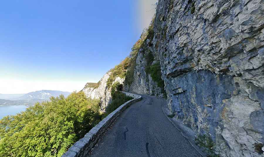
Col de la Chambotte
Perched high above the stunning turquoise waters of Lac du Bourget in the French Alps, the road to Col de la Chambotte offers a dramatic and unforgettable balcony driving experience. This paved, yet narrow and winding route, also known as Route de la Chambotte, stretches for 7.2 kilometers, revealing sweeping panoramic views of France's largest natural lake. While the scenery is breathtaking, the cliff-edge nature of the road, complete with unlit tunnels and limited guardrails, can make for a thrilling, even slightly scary, journey.
D656 Road
The D656 in the Var department is a short but spectacular balcony road in Provence, running just 5.2 km along the Siagne River. Fully paved yet extremely narrow and winding, it features sharp curves, hairpin turns, and rock-cut passages, making it unsuitable for long or heavy vehicles. With restrictions for those over 8m and 7.5 tons, the road is best enjoyed by experienced drivers or riders. Despite its challenges, it rewards travelers with dramatic cliffside views and a true taste of Provence’s wild mountain scenery.
Gorges de l’Escharis
The road through Gorges de l’Escharis winds along the Roanne River in southeastern France, offering turquoise waters, narrow gorges, and unspoiled landscapes. The 22.4 km stretch from Espenel to Saint-Nazaire-le-Désert features twists, turns, and scenic viewpoints, with small natural pools perfect for a summer swim. Secluded picnic areas and less crowded spots make it an ideal route for nature lovers and adventure seekers.