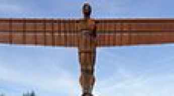
What are the most spectacular roads in England?
Located on the island of Great Britain, in the northern part of Europe, England is a country that shares borders with Scotland and Wales and covers an area of 130,279 square kilometers.
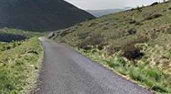
The roads in the country offer a bit of everything, with coastal drives, mountain roads and very steep streets. When travelling to England, you can’t miss Snake Pass, one of the best drives in the UK. At 512m (1,679ft) above sea level, the pass connects Manchester and Sheffield in Northern England and provides a challenging drive across the Pennines. For those preferring the most difficult challenges, don’t miss Hardknott Pass, one of the steepest roads in England, with a gradient of 1 in 3 (about 33%) or Porlock Hill, the steepest A road in England.
If you prefer different experiences, the country hosts the Stocksbridge Bypass. Featuring numerous reports of paranormal activity, it’s one of the Top Haunted Roads in the world. Or the stunning Swindon's Magic Roundabout, an insane 6-circle traffic junction within the Borough of Swindon. It has five smaller roundabouts directing traffic clockwise while cars travel counterclockwise around the inner circle. It's one of the world's 10 best roundabouts.
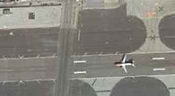
Winston Churchill Avenue cuts directly across the runway of the Gibraltar airport
Winston Churchill Avenue is one of the busiest roads in the British overseas territory of Gibraltar. The avenue cuts directly across the runway of Gibraltar Airport. If having to be cautious of other drivers wasn't enough, on Gibraltar's Winston Churchill Avenue, you have to watch out for planes too.
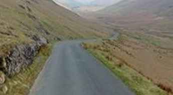
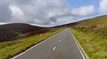
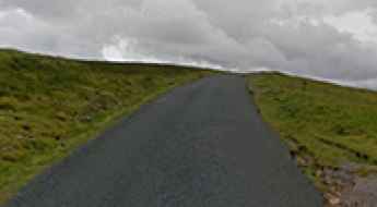
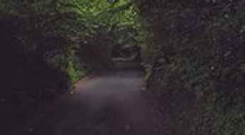
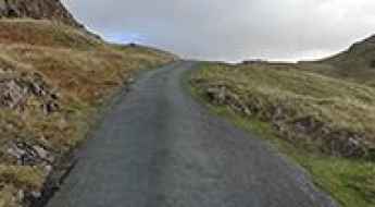
Newlands Pass is a narrow and perilously steep road in Lake District
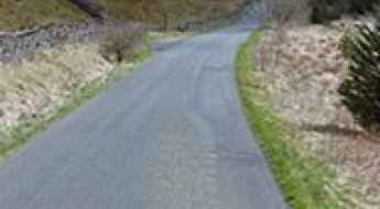
Newlands Pass is a mountain pass at an elevation of 333m (1,093ft) above sea level, located in the northern Lake District, in Cumbria, England. The route has humbled many egos.
M6 is said to be Britain's most haunted road
The M6, also known as the backbone of Britain, is the longest motorway in the United Kingdom and one of the busiest. At the same time, the six-lane-wide road is named Britain's most haunted road. It's one of the Top Haunted Roads in the world.
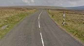
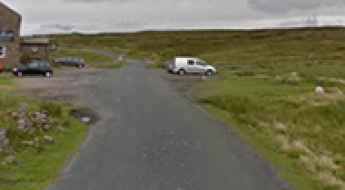
A road with challenging winter conditions to Newby Head Pass
Newby Head Pass is a mountain pass at an elevation of 440m (1,443ft) above sea level located in North Yorkshire, England.
10 Most Dangerous Roads to Drive on in the UK
While many of us enjoy a road trip, are there some roads we should be more aware of than others? This article will look at the 10 most dangerous roads to drive on in the UK, from high-altitude mountain passes to treacherous rural arteries.
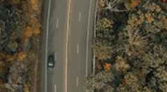
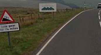
A682 is England's most dangerous road
Located in the central part of England, the defiant A682 is described as one of the most dangerous roads in the country. It has claimed over 100 lives in the last 10 years.
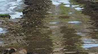
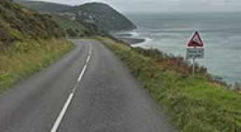
The Broomway is Britain’s most deadly path
Located in Essex, in the southeastern part of England, The Broomway is said to be Britain’s most deadly path, killing more than 100 people at over 600 years old. The Broomway is exceptionally dangerous.
A narrow road to Cow Green Reservoir in England
Cow Green is a reservoir at an elevation of 510m (1,673ft) above sea level, located on the county border between Cumbria and County Durham, in England.
The Olympics cycling Zig Zag road at Box Hill in England
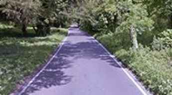
Zig Zag Road is a paved (pristine and smooth) drive winding its way up North Downs in Surrey county, in the South East of England. It has been dubbed as England's Most Twisty and Curved Road.
Discovering the Thrills of Whinlatter Pass: A Breathtaking Road in Cumbria
Whinlatter Pass is a mountain pass at an elevation of 337m (1,105ft) above sea level located in Cumbria, England.
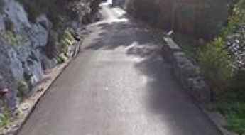
Adventure along the abandoned Old Mam Tor road
Located in the High Peak of Derbyshire, England, Old Mam Tor is the name of an abandoned road in 1979, after years of landslips. What's left of the road is still there, however impassible by cars.
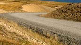
Cam High Road Is the Highest Road in England Outside of the North Pennines
Cam High Road is a narrow mountain road located in North Yorkshire, in England. It’s one of the highest roads in the country.
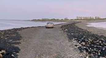
Osea Island Causeway is covered by sea water at high tide
Osea is a tidal island situated in the estuary of the River Blackwater in Essex, East England. Twice a day, the tidal causeway to the island disappears with the tides, leaving the area out to sea. It’s one of the periodically flooded roads around the world.
Darwin Road is a drive you'll never forget in the Falkland Islands
Darwin Road is a gravel road located in the Falkland Islands (Islas Malvinas), an archipelago in the South Atlantic Ocean on the Patagonian Shelf.
Harthope Moss is a very famous climb in England
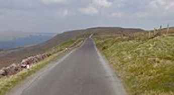
Harthope Moss is a mountain pass at an elevation of 628 m (2,060 ft) above sea level, located in County Durham, in England. It's one of the highest roads in the country.
The Strood is a flooded road to Mersea Island in UK
The Strood is the only road to Mersea Island in UK. It’s covered by the tide twice a day for one week during the month. It’s one of the periodically flooded roads around the world.
Driving the Awe-Inspiring Snaefell Mountain Road in the Isle of Man
Snaefell Mountain Road is a leading motorsport destination located on the north east of the Isle of Man.
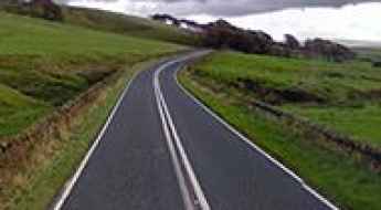
A39 road in England: The Ultimate Guide
The A39 Road is an extremely beautiful and rewarding drive to make in south-west England. The drive is definitely worth it, with stunning views and landscapes.
Driving the nerve-racking paved road to Killhope Cross
Killhope Cross is a mountain pass at an elevation of 629m (2,063ft) above sea level, located in England. It's one of the highest roads in the country.
B6277 is said to be the highest B-road in Britain
Located in historic County Durham, England, the paved B6277 is said to be the highest B-road in Britain.
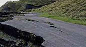
Driving the most unstable and technical coastal roads in England
England’s road network features specific stretches where geography and environmental decay create unique hazards for drivers. From coastal routes disappearing into the sea to high-altitude moorland tracks, these five sections demand precise driving and a clear understanding of the local terrain's physical instability.
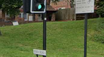
Jenkin Road in Sheffield is One of the Steepest Roads in the UK
Located in South Yorkshire, England, Jenkin Road is among the steepest climbs in the UK, boasting a maximum gradient of 17.2%.
A very narrow road to Chew Reservoir in Greater Manchester
Chew Reservoir is a reservoir at an elevation of 488m (1,600ft) above sea level, located in the Metropolitan Borough of Oldham in Greater Manchester, England. It was the highest constructed in England right up until 1971.
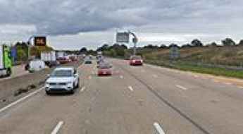
Why Is the M25 the Busiest Motorway in England?
Located in London, the capital of England, the M25 is an orbital motorway that almost completely encircles the country’s largest city. Officially known as the London Orbital Motorway, it is one of the busiest and most controversial roads in the United Kingdom. Loved by very few but used by millions, the M25 is essential for London’s transport network, linking counties, cities, airports, and major routes across the southeast of England.
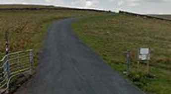
How to Get to Tan Hill Inn, the highest pub in Great Britain?
Located in the English county of North Yorkshire, Tan Hill Inn is the highest pub in Great Britain, at an elevation of 528m (1,732 ft) above the sea level.
Where are the highest pubs in the UK? A guide to the ultimate road trip stops
If you're scouting for pubs that combine history, great food, and spectacular views, consider heading to the UK's highest inns. From the captivating moors of North Wales to the scenic dales of North Yorkshire, these pubs offer more than just a pint.
Black Hill, an epic road in the North Pennine
Black Hill is a mountain pass at an elevation of 607m (1,991ft) above the sea leevel, located in the Cumbria/Northumberland border, in northeast England. It's one of the highest roads of the country.
Beachy Head Road
Beachy Head Road is a great coastal route on England’s southeast coast. Stunning views but take extra care on windy days.
Vigo Hill, a tough road in Kent
Located in the Borough of Gravesham in Kent, Vigo Hill is one of the toughest roads of England, hitting a 25% gradient.
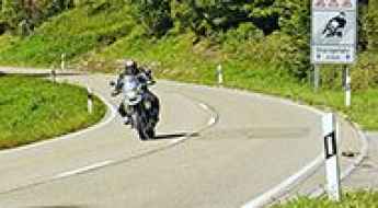
Motorcycle Safety: High-Risk Routes in the East Midlands
While motorcyclists account for only 1% of total road traffic in the UK, they represent a staggering 19% of all road fatalities. In regions like the East Midlands, where scenic rural A-roads meet heavy industrial corridors, the risk for bikers is particularly high. Understanding which sections are classified as having an "unacceptably high risk" is essential for any rider navigating this part of England.
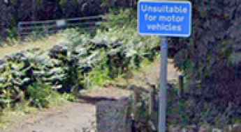
Is Bamford Clough in the Peak District the steepest road in England?
Located in the Peak District of England, Bamford Clough could be the steepest road in the world. A road sign warns drivers of a 35 percent gradient and that the way ahead is 'unsuitable for motor vehicles'.
The deadliest UK Road Accident Statistics
We looked at the latest DVLA and UK Gov statistics to find the most dangerous situations on UK roads. From age and gender to left vs right turns, we’ve statistical found the most common situations for road accidents. For instance- statistically, in the UK, you are most likely to have an accident as a 20-29 female, driving a car to work, when making a right turn on an urban road at a T junction.
Driving the UK’s Most Defiant Roads
Every motorist knows that driving can be dangerous every time that you get behind the wheel, but there are some roads that are much more dangerous than others. Road safety is paramount and you should always drive carefully, especially when you are driving on the UK’s most dangerous roads where there are many accidents each year. So, what are the UK’s most dangerous roads?
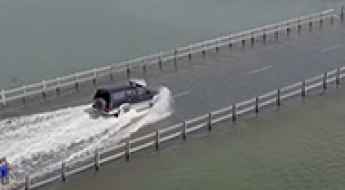
Things to Know Before Driving the Flooded Welney Wash Road
Located on the Norfolk Cambridgeshire border, in England, the infamous Welney Wash Road is one of the periodically flooded roads around the world.
Spur Battery
Spur Battery is an artillery battery at an elevation of 334m (1,095ft) above the sea level located in the British Overseas Territory of Gibraltar. It was built in 1902.

How to drive through London’s highest-risk traffic zones?
London is one of the most demanding urban environments for any driver. The conflict between narrow, historic streets and a massive volume of heavy vehicle traffic creates a unique form of "urban danger." Navigating the capital requires more than just a GPS; it requires an understanding of high-conflict nodes where congestion, restricted lanes, and complex roundabout systems turn a simple cross-town journey into a high-stakes driving challenge.