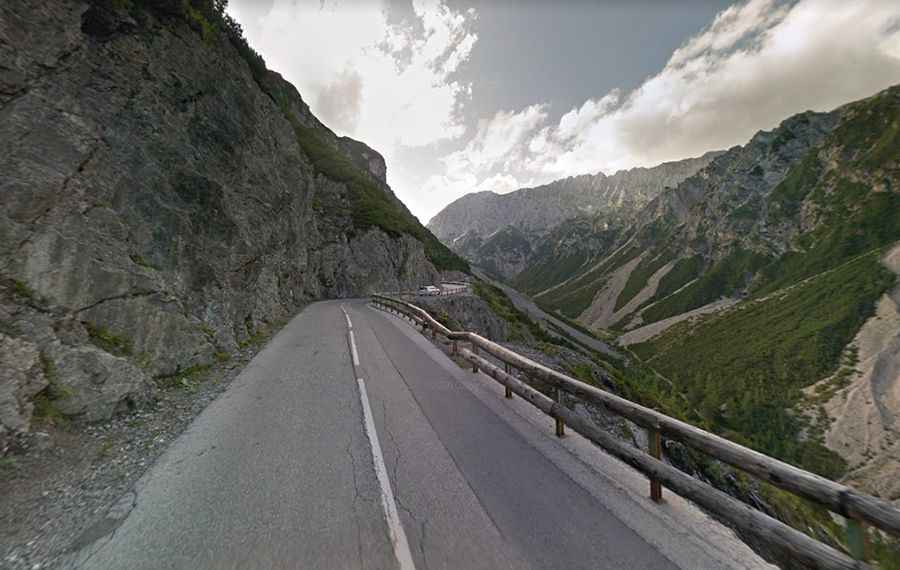
Driving the scenic road to Hahntennjoch Pass in the Austrian Alps
Hahntennjoch is a high mountain pass at an elevation of 1.897m (6,223ft) above sea level, located in the Austrian federal state of Tyrol. The road to the summit offers wonderful views along serpentine curves and alpine landscapes.
When was the road to Hahntennjoch built?
Between 1948 and 1969, only 10 construction workers built the road to the summit. Initially, it was a simple gravel road, but over time, it underwent widening and paving.
How long is the road to Hahntennjoch?
The road to the summit is totally paved. It’s called L266. The road is 28.4km (17.64 miles) long, running west-east from Elmen to Imst.
Is Hahntennjoch challenging?
The drive is not easy. It’s a curvy road running in very close to the cliff. The road is very narrow and in the summer season there are enough crazy motorbike riders that try to pass by in the most dangerous situations. The accident frequency is accordingly high. The road is winding and steep, with grades up to 19%. Watch out for cattle grids on the ground.
Is Hahntennjoch open?
Set high in the Austrian Alps, the road is generally closed from November to April (depending on snow). It is closed to vehicles over 14 metric tons. The pass is prone to "Muren", avalanches, falling rocks, and mudslides which go off in the Alps with hard rain and thunderstorms. Large warning signs refer to these dangers and on the left and right side of the road, gravel waste piled up talks about past slides and give an idea of which forces of nature is able. In 2004, an automatic system was installed that closes the road in case of blockage.
How long does it take to drive the road to Hahntennjoch?
To drive the road without stopping will take most people between 35 and 45 minutes. The drive is very scenic, with views of glacier-carved valleys, daunting peak summits and densely wooded areas. Numerous small restaurants line the pass today and gladly look after visitors.