The Triangulo de la Pantaloneta in Spain terrifies Russian and Ukrainian truck drivers
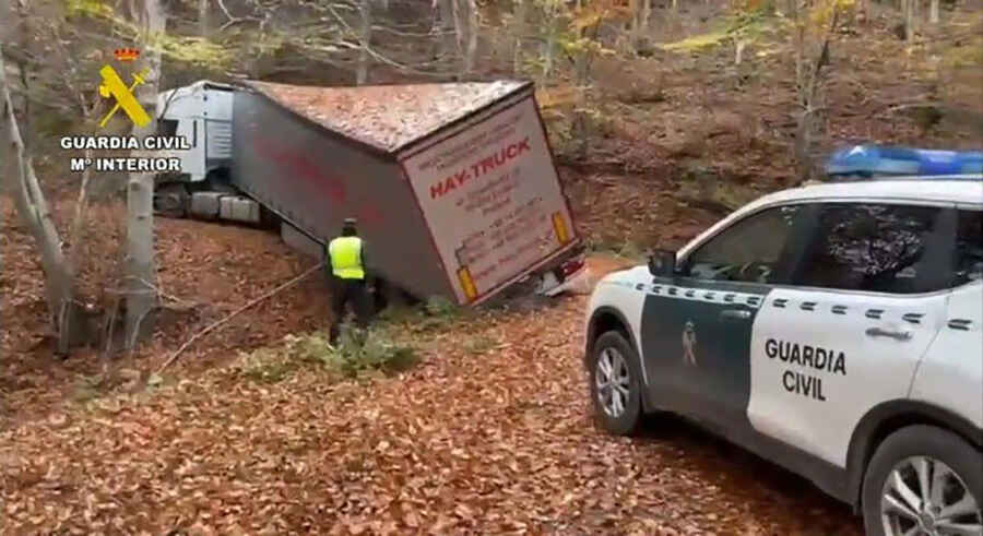
Triangulo de la Pantaloneta is an area, located in the La Rioja region of Spain, that has gained notoriety as authorities frequently need to intervene to rescue trucks stuck amid steep roads, trees, and thick vegetation.

Since 2015, the Sierra de la Demanda in La Rioja has witnessed numerous trucks getting stuck in what is known as the 'Pantaloneta Triangle.' More than a dozen drivers have gone astray this year alone, searching for a nonexistent gas station. This is due to a flaw in the GPS coordinates used by truck drivers and mostly affects Slavic trucks.
The latest case occurred on November 21 when the Spanish police reported that a truck driver of Ukrainian origin had become stuck in this wooded area of La Rioja. Authorities had to assist the vehicle trapped on a narrow road after following incorrect directions from the navigation system.
Where is the Pantaloneta Triangle?
The Pantaloneta Triangle is located in the area formed by the municipalities of Bañares, Posadas, and Nestares. Similar to the popular Bermuda Triangle, this mountainous area enclosed by a perfect triangle is to blame for many trucks getting lost and stuck. The locals dubbed this area with the name 'pantaloneta.'
The confusion arises from GPS devices used by drivers, as they indicate the presence of a gas station in Turza, a small hamlet in the municipality of Ezcaray with nine inhabitants living without electricity, gas, light, or drinking water. Companies in the sector have stated that no such gas station exists there; instead, it is located in La Jonquera (Girona). Therefore, drivers are destined to get lost in the middle of the forest if they follow the navigator's directions.