What are the most spectacular roads in Bosnia and Herzegovina?
Located in the heart of the Balkans, Bosnia and Herzegovina is a paradise for 4x4 enthusiasts, as the country hosts a large number of unpaved roads climbing up to mountains.
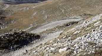
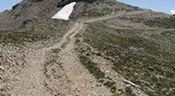
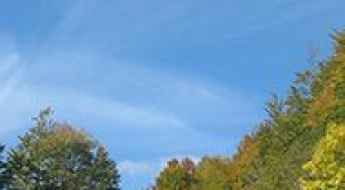
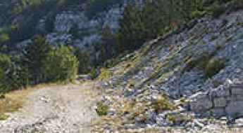
If you’re up for a gravel mountain road, you can’t miss driving the 17 hairpins on the road to Bjelašnica, a mountain peak at an elevation of 2.056m (6,745ft) above sea level in the Sarajevo Canton. Or drive to Pločno in the Čvrsnica mountain, the roof of Bosnia and Herzegovina, at 2.204m (7,230ft) above sea level. If you’re seeking wild experiences, Brasina offers one of the best offroad experiences in Bosnia and Herzegovina, with a mountain peak at 1.873m (6,145ft) above sea level. It’s one of the best offroad experiences in the country. Due to the hazardous area (mine fields), do not hike or ride outside of the dirt road. The road climb is very steep, with sections reaching up to 14%.
Remember some areas are marked with reminders of past conflicts, with the lurking risk of mines. Landmines and other unexploded weapons remain from the 1992 to 1995 war. While highly populated areas and major routes are largely clear, there is still a risk in less populated and rural
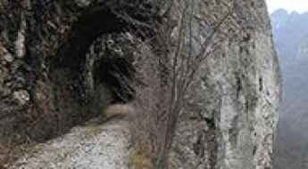
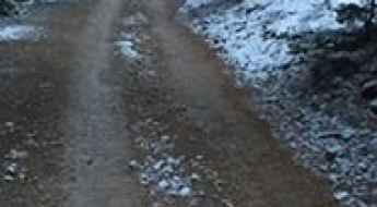
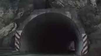
Bosnian Former Eastern Railway is a gravel track with 99 tunnels
The former Bosnian Eastern railway has turned into a dirt track near the zone of Pale, a municipality in Bosnia and Herzegovina.
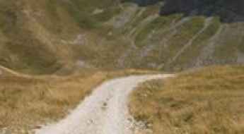
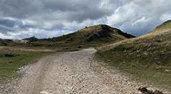
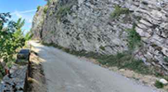
17 hairpins and mine risk on the road to Bjelašnica
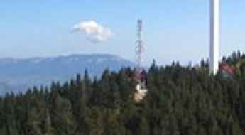
Bjelašnica is a high mountain peak at an elevation of 2.056m (6,745ft) above sea level, located in the Sarajevo Canton of Bosnia and Herzegovina.
Zeljava Air Base was the largest underground airport in Yugoslavia
Located on the border between Croatia and Bosnia and Herzegovina, Željava Air Base was the largest underground airport and military airbase in the former Yugoslavia, and one of the largest in Europe.
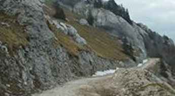
Driving to Pločno in the Čvrsnica mountain, the roof of Bosnia and Herzegovina
Pločno is a high mountain peak at an elevation of 2.204m (7,230ft) above sea level, located in the Federation of Bosnia and Herzegovina, in Bosnia and Herzegovina.
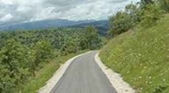
A paved mountain road to Cemerno Pass in Bosnia and Herzegovina
Čemerno Pass is a high mountain pass at an elevation of 1.301m (4,268ft) above sea level, located in the Republika Srpska of Bosnia and Herzegovina.
Road M5 is a narrow former railway through the Prača Canyon
M5 is a challenging mountain road located in eastern Bosnia and Herzegovina, running along the former Bosnian Eastern Railway ("Ostbahn") through the Prača Canyon. It’s definitely not for anyone suffering from vertigo or fear of landslides.
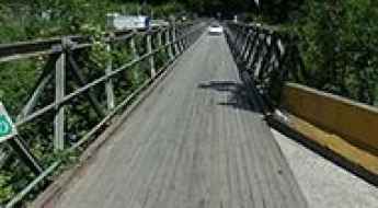
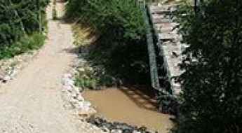
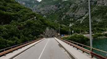
The international wooden Šćepan Polje bridge
Šćepan Polje is the name of an international bridge on the border of Montenegro and Bosnia & Herzegovina. It’s one of the most spectacular bridges in the world.
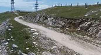
Brasina is one of the best offroad experiences in Bosnia and Herzegovina
Brasina is a high mountain peak at an elevation of 1,873m (6,145ft) above sea level, located in the Federation of Bosnia and Herzegovina. It’s definitely one of the best offroad experiences in the country. Due to hazardous areas (minefields), do not hike or ride outside of the dirt road. The climb is very steep, with sections up to 14%.
A 4x4 Road You'll Never Forget to Stog Peak in the Zelengora Mountains
Pogled na Stog is a high mountain peak at an elevation of 1,738m (5,702ft) above sea level, located in Republika Srpska, in Bosnia and Herzegovina.
How to Get to Paljenik by Car
Paljenik is a high mountain peak at an elevation of 1,933m (6,341ft) above sea level, located in the Central Bosnia Canton of the Federation of Bosnia and Herzegovina.
How can I get by car to Gola Plješevica?
Gola Plješevica is a high mountain peak at an elevation of 1,547m (5,075ft) above sea level, located on the border of Croatia and Bosnia and Herzegovina.
A Memorable Road Trip to Velika Klekovaca
Velika Klekovača is a high mountain peak at an elevation of 1,946m (6,384ft) above sea level, located in western Bosnia and Herzegovina. The wind at the top is no joke.
How to get by car to Trebevic Mountain?
Trebević Mountain is a high mountain peak at an elevation of 1,232 m (4,041 ft) above sea level, located in the territories of Republika Srpska, Sarajevo, and East Sarajevo city, in Bosnia and Herzegovina.
How to drive through Neretva Canyon?
Neretva Canyon is a very scenic canyon located in the Herzegovina-Neretva Canton of Bosnia and Herzegovina.
The Wild Road to Vranica
Vranica is a high mountain pass at an elevation of 2.047m (6,715ft) above the sea level, located in central Bosnia and Herzegovina.
Crveni Klanac
Crveni Klanac is a high mountain pass at an elevation of 1.599m (5,246ft) above the sea level, located in central Bosnia and Herzegovina.
Jahorina
Jahorina is a high mountain peak at an elevation of 1.887m (6,190ft) above the sea level, located in Republika Srpska, an entity of Bosnia and Herzegovina.
Road R467
R467 is a very scenic journey located in Republika Srpska of southeastern Bosnia Hercegovina, running through the Lim River canyon with tunnels and bridges.
Crepoljsko
Crepoljsko is a mountain peak at an elevation of 1.480m (4,855ft) above the sea level, located in the municipality of Stari Grad, Sarajevo, in Bosnia and Herzegovina.
Ultimate 4wd destination: Orlovačko Lake
Orlovačko Jezero is a beautiful glacial Lake at an elevation of 1.452m (4,763ft) above the sea level, located in Republika Srpska, in southern Bosnia and Herzegovina.
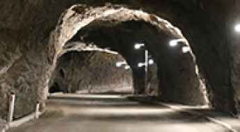
Driving Ponikve Tunnel through a cave
Tunel Ponikve is located north of Sarajevo in the municipality of Vareš, Bosnia and Herzegovina. It is a road tunnel that uses the natural Ponikva Cave (Pećina Ponikva). It’s one of the few roads in the world that runs through a cave.
Driving the Unpaved Road to Vrgorac in Southern Bosnia and Herzegovina is for Brave Drivers Only
Vrgorac is a mountain peak at an elevation of 1,247m (4,091ft) above sea level, located in Republika Srpska, in Bosnia and Herzegovina.