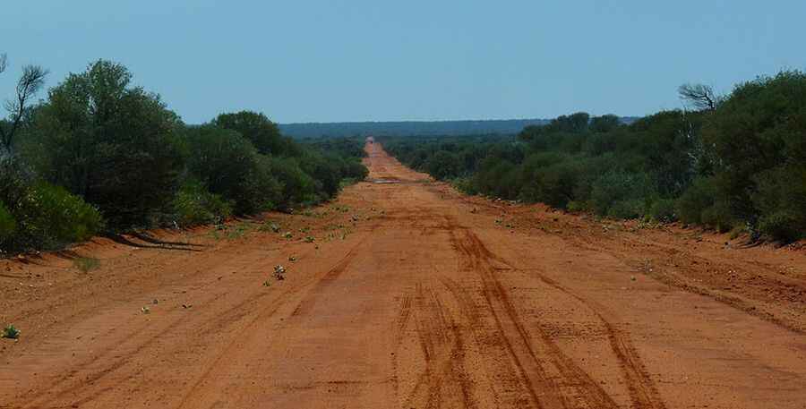
Anne Beadell Highway in Australia is the perfect 4x4 trail
Anne Beadell Highway is an awe-inspiring route that passes through extremely remote desert areas of Australia. The track is suitable for only well-provisioned and experienced four-wheel drivers. It’s one of the Australian longest roads.

How long is the Anne Beadell Highway?
The outback unsealed track is 1.325km (823 mi) long, running west-east from Laverton (in Western Australia) to the Stuart Highway, at Coober Pedy (in South Australia). The track is suitable for only well provisioned and experienced four wheel divers, running through some of the most isolated and harsh areas in Australia.
When was the Anne Beadell Highway built?
The road was constructed by Len Beadell over a period of about 9 years, from 1953 to 1962 and named after his wife's name, Anne. Construction was completed in five stages. He was also responsible for building the Gunbarrel Highway and others, and named this track after his wife, Anne. Several of the roads and tracks that his team built were named after family members. The road was constructed to provide access for a series of surveys adding to the overall geodetic survey of unexplored parts of Australia. The information was required for rocket range projects at Woomera. Part of this area was the British Atomic Test site during the 1950's at Emu where two atomic bombs were exploded.
Is the Anne Beadell Highway challenging?
The track is often very narrow, twisty and sandy. There are no settlements between Coober Pedy and Laverton. Sand dunes predominate for most of the track. The longest stretch without fuel is about 750 km (466 miles) and is best travelled from May through to September. Because the track is remote and not signposted, GPS is advisable and HF radio or satellite phone are recommended. Hazards such as flat tyres, breakdowns, and the occasional flash floods must be taken into account. Unless you are a hugely experienced desert traveller, solo travel is not recommended. The area is still barren.
When is the best time to drive the Anne Beadell Highway?
The track passes through remote arid deserts and scrub territory of South Australia and Western Australia, which often have summer temperatures as high as 50°C. Avoid summer months as temperatures are extremely high. In other seasons, night temperatures can drop below freezing. Be prepared with jackets, water, and emergency kit in your car.
How long does it take to drive along the Anne Beadell Highway?
To drive the road will take most people between 5 and 7 days in good conditions. The scenery is breathtaking along the way as the terrain slowly changes from clay pans and salt lakes to red sand dunes. The track through conservation parks and Aboriginal Land and four wheel drive enthusiasts will appreciate the vastness of the landscape on this route, as well as the dense scrub and challenges of the sandy track. Be sure to stop by and experience the old Yeo Homestead, Yamarna Station and Djinkagara along the way. There are numerous small dunes to cross, interesting history and sites at Anne's Corner, Volkes Hill Corner, Serpentine Lakes and the border. Ilkurlka roadhouse is a welcome rest point offering a hot shower, supplies and fuel, with an aircraft wreck not far away, followed by Neales Junction. Len's markers and signs offer intriguing points of interest and a guiding path along the track.
Pic: By Marian Deschain (Own work) [CC BY-SA 3.0 (https://creativecommons.org/licenses/by-sa/3.0)], via Wikimedia Commons