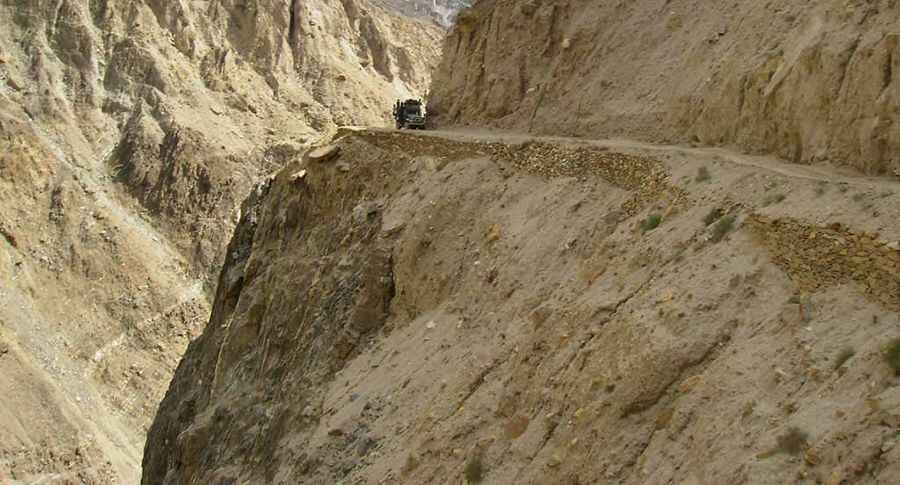
Haramosh Valley Road: don’t try the drive in rain or after the sunset.
Located in the Gilgit district, Northern Areas, in northern Pakistan, the Haramosh Valley Road is a narrow gravel road, pretty steep with dangerous dropoffs. Don’t try the drive in rain or after the sunset.

Located within the Phuparash Valley, this is some serious driving. The road links the towns of Sassi and Dache (Dassu). The journey is 17.3 km (10,74 mi). It’s a mind numbing vertical drop of hundreds of meters so you might want to give it a miss on a windy day. The road is hindered by the elevation and rugged terrain. The road is difficult and it’s a nightmare in the wet or dark (or both). Expect hundreds of turns (with several hairpin turns). The journey runs along the Phuparash river. The road winds its way to the north-western part of the Haramosh massif, a subrange of the Karakoram mountains. In many places the road is bordered by a drop of hundreds of meters (many hundreds of feet) unprotected by guardrails. Do not travel this road in severe weather conditions. Avalanches, heavy snowfalls and landslides can occur anytime, being extremely dangerous due to frequent patches of ice.
The road is pretty steep. It starts from the small town of Sassi, at 1.401m above the sea level, and ends beyond Dache (Dassu), at 2.336m. The elevation gain is 935m and the average gradient is 5.4%, with sections up to 9%. A 4WD vehicle and an experienced driver are recommended.
Road suggested by: Hugh Wilson
Pic&more info: http://www.rockhawks.com/PhotoGalleries/exp_07_haramoshrange_kutwallake.html