What are the most spectacular roads in Kyrgyzstan?
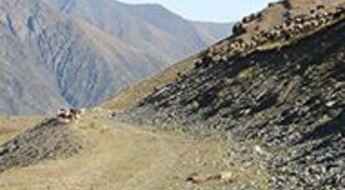
Nestled in the heart of Central Asia, Kyrgyzstan offers drivers a captivating journey through time and terrain. Its roads, ranging from the remnants of ancient trade routes to rugged mountain passes, tell stories of empires, nomads, and nature's grandeur.
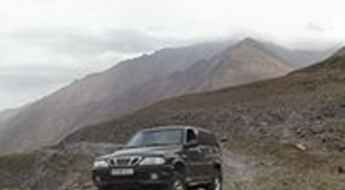
The Pamir Highway stands as a testament to mankind's engineering prowess and the indomitable spirit of travel. As the second highest altitude international highway in the world, it offers views that are unparalleled, making every twist and turn a visual delight. The Torugart Pass, a significant border crossing between Kyrgyzstan and China, has served as a historical junction for cultures and trade, highlighting the country's position as a bridge between diverse worlds.
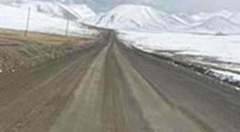
Then there's the Kok-Airyk Pass, a testament to nature's capriciousness. Open only during the short window of July and August, it challenges drivers with its unpredictable conditions, and rewards them with views that are ephemeral and enchanting. Beyond these iconic routes, the remnants of the ancient Silk Road meander through Kyrgyzstan, allowing travelers to trace the footsteps of ancient merchants and explorers. As one navigates the nation's roads, the juxtaposition of Eastern and Western influences, the echoes of nomadic tales, and the ever-present Islamic cultural nuances become evident.
In essence, driving in Kyrgyzstan is not just about reaching a destination; it's a journey through the pages of history, across the tapestry of diverse cultures, and amidst some of the most breathtaking landscapes on earth.
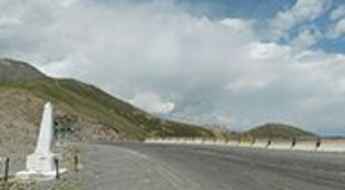
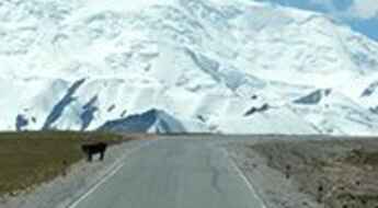
Torugart Pass is a challenging border crossing between Kyrgyzstan and China
Torugart Pass is a high mountain pass at an elevation of 3.752m (12,310ft) above sea level, located on the border of Kyrgyzstan and China. It’s one of the highest roads of the country.
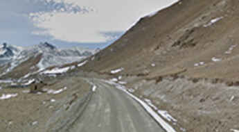
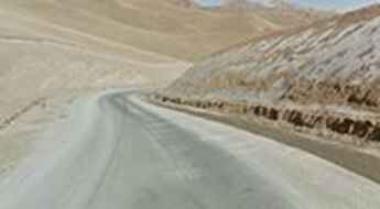
Pamir Highway is the second highest altitude international highway in the world
The historical Pamir Highway (M41) is an excellent challenge for 4x4 adventure travelers. Most of the road is paved (in very bad conditions) and stretches more than 1,200km between Osh (in Kyrgyzstan) and Dushanbe (in Tajikistan) through the Pamir Mountains. The road is heavily damaged in places by erosion, earthquakes, landslides, and avalanches.
What are the highest roads in Kyrgyzstan?
Kyrgyzstan is a high mountain country located in Central Asia. Over ninety percent of the country is mountainous territory, so almost any journey, anywhere in the country involves crossing over a mountain pass.
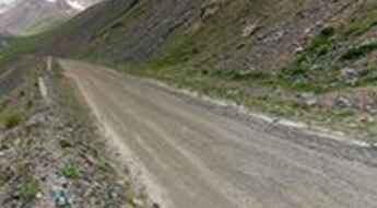
Tossor Pass is a thrilling (scary) off road experience in Kyrgyzstan
Pereval Tossor is a high mountain pass at an elevation of 3,901m (12,798ft) above sea level, located in the Issyk-Kul Region of Kyrgyzstan. It’s one of the highest roads in the country.
9 whiplash-inducing switchbacks to Too Ashuu Pass
Töö Ashuu is a high mountain pass at an elevation of 3,576m (11,732ft) above sea level, located in the Chuy Region of Kyrgyzstan. This is definitely not a Sunday drive. Drive with care as this is a mountain road with dangerous drop-offs.
Driving The Wild 4x4 Road to Song Kol
Song Köl is an alpine lake at an elevation of 3,048m (10,000ft) above sea level, located in northern Naryn Province, Kyrgyzstan.
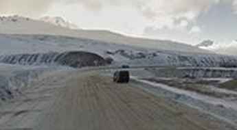
Kok-Airyk Pass is only passable on July and August
Pereval Kok Airyk is a high mountain pass at an elevation of 3.850m (12,631ft) above the sea level, located in the Issyk-Kul region of Kyrgyzstan. Driving through the pass, the driver will negotiate about 15 snaking sections of uncovered road with some stony places. It’s one of the highest roads of the country.
Conquering the Frightening Too Ashuu Tunnel: Navigating Kyrgyzstan's High Altitude Challenge
Töö Ashuu Tunnel is a high mountain tunnel at an elevation of 3.180m (10,433ft) above the sea level, located in the Chuy Region of Kyrgyzstan.
The serpentine road to Moldo-Ashuu Pass is a breathtaking mountain challenge
Moldo-Ashuu Pass is a high mountain pass at an elevation of 3.346m (10,977ft) above the sea level, located in the Naryn Region of Kyrgyzstan. It's one of the most famous hairpinned roads in the world.
Adventures on the unpaved road to Kegety Pass
Pereval Kegety is a high mountain pass at an elevation of 3.785m (12,417ft) above the sea level, located in the Naryn Region of Kyrgyzstan. It’s one of the highest roads of the country.
Driving the historic Pamir Highway to Taldyk Pass
Pereval Taldyk is a high mountain pass at an elevation of 3,615m (11,860ft) above the sea level, located in the Osh Region of Kyrgyzstan.
A journey on the legendary Pamir Highway to Kyzylart Pass
Kyzylart Pass is an international high mountain pass located on the Tajikistan-Kyrgyzstan border, at an elevation of 4.292m (14,081ft) above the sea level. It’s one of the highest roads of the country.
How to Get to Tash Rabat Caravanserai by Car?
Located in the At-Bashy district of the Naryn region in Kyrgyzstan, Tash Rabat is a stone caravanserai—an extensive network of traveler’s inns along old caravan roads—in the middle of nowhere.
Pereval Barskaun: recommended for the drivers with strong nerves
Pereval Barskaun is a high mountain pass at an elevation of 3.760m (12,335ft) above the sea level, located in the Tian Shan mountains of the Region Issyk-Kul, in Kyrgyzstan. It’s one of the highest mountain roads of the country.
Here's How To Have The Ultimate Road Trip To Erkeshtam Pass
Erkeshtam Pass is an international high mountain pass at an elevation of 2.838m (9,311ft) above the sea level, located on the border of Kyrgyzstan and China. This is a popular border crossing for travelers journeying across Central Asia.
Seok Pass is a road you'll never forget
Seok Pass is a high mountain pass at an elevation of 4.024m (13,202ft) above the sea level, located in the Region Issyk-Kulin of Kyrgyzstan. It’s one of the highest mountain roads of the country.
Crossing Dolon Pass is rather complicated
Dolon Pass is a high mountain pass at an elevation of 3.030m (9,940ft) above the sea level, located in the Naryn Province of Kyrgyzstan.
A white desert road to Pereval Ala-Bel
Ala-Bel Pass is a high mountain pass at an elevation of 3.175m (10,416ft) above the sea level, located in the Talas Ala-Too mountain range of Kyrgyzstan.
The Road To Chong Ashuu Pass Has it All!
Chong Ashuu Pass is a high mountain pass at an elevation of 4,011m (13,159ft) above sea level, located in the Issyk-Kul region of Kyrgyzstan. It’s one of the highest roads in the country.
Dare to drive the dangerous Pereval Arabel
Pereval Arabel is a high mountain pass at an elevation of 3.839m (12,595ft) above the sea level, located in the Tian Shan mountains of the Region Issyk-Kulin in Kyrgyzstan. It’s one of the highest mountain roads of the country.
Crossing the spectacular Naryn river bridge
Naryn river bridge is a wooden bridge located in the Naryn Province in central Kyrgyzstan. It’s one of the most spectacular bridges in the world.
The Ultimate Guide to Traveling the Pereval Kaldama
Pereval Kaldama is a high mountain pass at an elevation of 2.992m (9,816ft) above the sea level, located in the Fergana valley, in southwestern Kyrgyzstan.
The road to Kara-Keche Pass is truly an unforgettable experience
Kara-Keche Ashuu Pass is a high mountain pass at an elevation of 3.384m (11,102ft) above the sea level, located in Naryn province, Kyrgyzstan.
Crossing the Kyzyl-suu River Bridge in Kyrgyzstan
Kyzyl-suu river bridge is an iron bridge located in the Osh Region of Kyrgyzstan. It’s one of the most spectacular bridges in the world.
Terskey Torpok Pass: Ultimate 4wd destination
Pereval Teskeytorpo is a high mountain pass at an elevation of 3.160m (10,367ft) above the sea level, located in the Kochkor District of Kyrgyzstan.
A very bumpy, grueling road to Mingtur Pass
Pereval Ming-Tur is a high mountain pass at an elevation of 3.707m (12,162ft) above the sea level located in Ysyk-Köl, Kyrgyzstan.
Engilchek mine
Located in Ak-Suu District, southeast Issyk-Kul Region, in Kyrgyzstan, Engilchek mine was a tungsten, tin, molybdenum and other metals mine, topping out at 3.791m (12,437ft) above the sea level. It’s one of the highest roads of the country.
The Wild Road to Uch-Chat Ashuu Pass
Uch-Chat Ashuu Pass is a high mountain pass at an elevation of 3.731m (12,240ft) above the sea level, located in the Region Issyk-Kul, in eastern Kyrgyzstan. It’s one of the highest mountain roads of the country.
An awe-inspiring drive to Ak-Beyit Pass
Pereval Akbeit (Ak-Beyit Pass) is a high mountain pass at an elevation of 3.289m (10,790ft) above the sea level, located in Naryn Region, in the east of Kyrgyzstan.
Pereval Kara-Buura
Pereval Kara-Buura is a high mountain pass at an elevation of 3.301m (10,830ft) above the sea level, located in the Talas Region of Kyrgyzstan.
Pereval Kizol-bel’
Pereval Kizol-bel’ is a high mountain pass at an elevation of 3.298m (10,820ft) above the the sea level, located in the Talas Region of Kyrgyzstan.
Road A367
A367 is a high mountain road located in the Tian Shan Mountains, in the northern Naryn Region of Kyrgyzstan.
A wild mountain road to Karakyr Pass
Pereval Karakyr is a high mountain pass at an elevation of 4.043m (13,264ft) above sea level, located in the Issyk-Kul region of Kyrgyzstan. It’s one of the highest roads in the country.
The road to Kalmak Ashuu Pass has taxed the nerves of more than a few drivers
Pereval Kalmakashu is a high mountain pass at an elevation of 3.446m (11,305ft) above the sea level, located in the Naryn province of Kyrgyzstan.
Min-Kush Road
Min-Kush Road is a short mountain road located in the Jumgal District of Naryn Province of Kyrgyzstan.
River Kara-kysmak bridge
The River Kara-kysmak bridge is a wooden bridge located in the Talas Region of Kyrgyzstan. It’s one of the most spectacular bridges in the world.
