K-G Pass, everything you need to know about this famed Afghan road
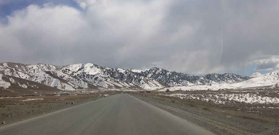
Khost-Gardez Pass is a high mountain pass at an elevation of 2.897m (9,504ft) above sea level, located on the boundary between Paktia and Khost provinces of Afghanistan.
Where is K-G Pass?
The pass is located in the southeastern part of the country, high in the southern Hindu Kush mountains.
Why is it called Khost-Gardez Pass?
Khost-Gardez Pass is named after Khōst and Gardez, the two villages that the road through the pass links.
Why is K-G Pass famous?
The pass, frequently abbreviated as K-G Pass, has been in use since antiquity, serving as one of the main routes connecting Kabul to Southern Asia. During the Soviet occupation, the pass was a frequent location for Mujahideen attacks on Soviet convoys.
Is K-G Pass paved?
The road to the summit, also known as Seti-Kandow Pass and Satukandav Pass, was paved by construction crews as part of the international reconstruction effort in Afghanistan.
How long is K-G Pass?
The pass is 102km (63 miles) long, running east-west from Khōst (the capital city of Khost Province) to Gardez (the capital of Paktia Province).
Is K-G Pass open?
Always check the weather forecast before you start your journey, as a high amount of snowfall in winter months is common.
Is K-G Pass dangerous?
If you do choose this route, please check up-to-date information due to the security situation. Obviously, you would have to really (!) check what is going on now. You might want to contact your embassy in Kabul as they have the best info about terrorist attacks, ongoing armed conflict, the risk of kidnapping, and the high crime rate.
Pic: Abdullah Noori