What are the most spectacular roads in Algeria?
Located in the northern part of Africa, driving the roads of Algeria is an experience like no other. The 80% of the country is desert and its landscape comprises mountains, plateaus, and coastal plains as well. So, finding a great road trip is not difficult at all.
If you want to discover the country by road, you must try the Trans-Sahara Highway, a 4,500-kilometer road traversing Algeria’s landscape, as well as parts of Niger and Nigeria. In the northern part of the country, you can try to drive to Tikjda Pass, a mountain pass at an elevation of 1.462m (4,796ft) above sea level. Situated in the province of Bouïra, it offers a scenic drive through the Kabylie mountains. For those seeking a journey to the heights, Col de Tirourda is a high mountain pass, at 1.737m (5,698ft) above sea level, marking the boundary between Bouïra and Tizi Ouzou provinces in the northern part of the country.
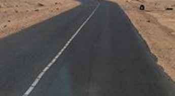
Trans-Sahara Highway is 4.500km of true adventure in Africa
Trans-Sahara Highway is one of the most brutal roads in the world. Running for 4,500km through Algeria, Niger and Nigeria, it's a real test that attracts the brave and the crazy.
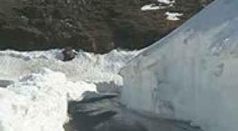
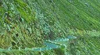
How to drive to Tikjda Pass in northern Algeria
Tikjda Pass is a mountain pass at an elevation of 1.462m (4,796ft) above sea level, located in the province of Bouïra, in Algeria.
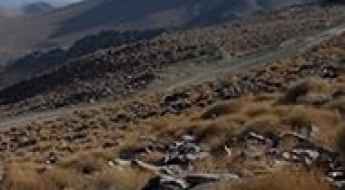
Mount Chelia: Driving the 2,293m unpaved peak in Algeria
Mount Chelia is the highest mountain peak in northern Algeria, reaching an elevation of 2,293 meters (7,522 ft) above sea level. Situated on the border between the Khenchela and Batna provinces, the track leading to the summit is a raw, unpaved mountain path that forces vehicles to climb steep ridges, deep ruts, and sharp limestone fields within the Aurès Mountains.
Travel Guide to the Top of Col de Tirourda
Col de Tirourda is a high mountain pass at an elevation of 1,737m (5,698ft) above sea level, located in Algeria.
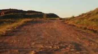
Driving the rugged Route de l'Assekrem in the Hoggar Mountains
Assekrem is a high mountain plateau that reaches 2,708 meters in the Tamanrasset Province of southern Algeria. Located deep within the Hoggar Mountains (Ahaggar), the Route de l'Assekrem is one of the most legendary and punishing desert tracks in the Sahara. This is a world of twisted volcanic basalt and jagged peaks where the road is a constant battle against the "tôle ondulée" (corrugated road) and sharp rocks. Driving here means entering a silent, lunar landscape where the desert's heat and the mountain's altitude combine to push any 4x4 to its absolute limit.
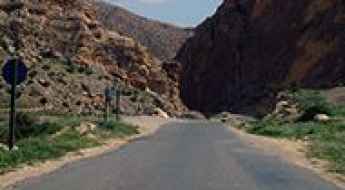
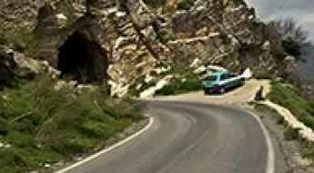
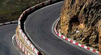
Driving the N-31 road through Col-Ain-Tinne in the Aures region
Col-Ain-Tinne (also known as Teniet Bou Irhyal) is a high mountain pass reaching an elevation of 1,686m (5,531ft) above sea level, located in the Batna province of northeastern Algeria. Situated in the heart of the Aures region, the pass follows the Route Nationale 31 (N-31), crossing a spectacular limestone gorge with extreme vertical walls.
How to drive the paved road to Tizi-n-Kouilal?
Tizi-n-Kouilal is a high mountain pass at an elevation of 1.565m (5,134ft) above sea level, located in Algeria.
Azrou n'Thor
Azrou n'Thor is a high mountain peak at an elevation of 1.800m (5,905ft) above the sea level, located in Tizi Ouzou Province in northern Algeria.
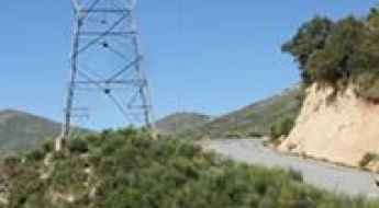
Tizi Tirkabine: Driving the N30 through the Djurdjura Mountains
Tizi Tirkabine is a high mountain pass at an elevation of 1,362 meters (4,468 ft) above sea level, located in the Bouïra Province of northern Algeria. Situated within the rugged limestone ridges of the Djurdjura Mountains and the Djurdjura National Park, the pass is traversed by the paved National Road 30 (N30), which forces drivers to manage narrow lanes, broken mountain asphalt, and sharp unprotected drops.
How to drive the paved road to Azrou Ou Gougane?
Azrou Ou Gougane is a high mountain pass at an elevation of 1.867m (6,125ft) above sea level, located in Tizi Ouzou Province in Algeria.
A great drive to Col de Bouhmama
Col de Bouhmama is a high mountain pass at an elevation of 1,707m (5,600ft) above sea level, located in Khenchela Province, Algeria.